Downtown Springfield in Greene County, Missouri — The American Midwest (Upper Plains)
Butterfield Overland Stage
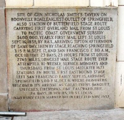
Site of Gen. Nicholas Smith's tavern on Boonville Road, earliest outlet of Springfield, also station of Butterfield Stage Route carrying first overland mail from St. Louis to Pacific Coast. Government subsidy $600,000 yearly. First mail left St. Louis Sept. 16, 1858, by rail, arriving Tipton afternoon of same day, then by stage, reaching Springfield 3:15 p.m., Sept. 17, and San Francisco 7:30 a.m. Oct. 10. Time 23 days, 23 hours from St. Louis, 2765 miles. Longest mail stage route ever attempted. Bi-weekly service Mondays and Thursdays from St. Louis. 141 (later 167) stations en route. First eastbound stage left San Francisco early Sept. 15, arriving Springfield 3:00 p.m., Oct. 8, where hundreds welcomed its arrival as great event. Banquet; speeches; fireworks. Time eastward trip, 24 days, 18 hours to St. Louis.
Erected Nov. 1932.
Erected 1932 by University Club. (Marker Number 18.)
Topics and series. This historical marker is listed in these topic lists: Communications • Industry & Commerce • Roads & Vehicles • Settlements & Settlers. In addition, it is included in the Butterfield Overland Mail series list. A significant historical date for this entry is September 16, 1831.
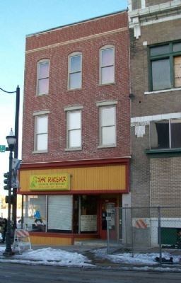
Location. 37° 12.578′ N, 93° 17.529′ W. Marker is in Springfield, Missouri, in Greene County. It is in Downtown Springfield. Marker is at the intersection of Park Central North and Olive Street, on the left when traveling south on Park Central North. Touch for map. Marker is at or near this postal address: 222 Park Central North, Springfield MO 65806, United States of America. Touch for directions.
Other nearby markers. At least 8 other markers are within walking distance of this marker. Dedicated to the Loving Memory of Dr. R. Fred Schweitzer (within shouting distance of this marker); History of Springfield Public Square (about 300 feet away, measured in a direct line); Three Black Men Lynched (about 300 feet away); Battle of Springfield (about 300 feet away); a different marker also named Battle of Springfield (about 300 feet away); 1971 Tumbler (about 300 feet away); Lynching in America / The Lynchings of Horace B. Duncan, Fred Coker and William Allen (about 400 feet away); Wild Bill's Shootout (about 400 feet away). Touch for a list and map of all markers in Springfield.
Also see . . .
1. Butterfield Overland Stage. (Submitted on June 3, 2011, by William Fischer, Jr. of Scranton, Pennsylvania.)
2. Springfield-Greene County Local History. (Submitted on June 3, 2011, by William Fischer, Jr. of Scranton, Pennsylvania.)
Credits. This page was last revised on February 16, 2023. It was originally submitted on June 3, 2011, by William Fischer, Jr. of Scranton, Pennsylvania. This page has been viewed 931 times since then and 25 times this year. Photos: 1, 2. submitted on June 3, 2011, by William Fischer, Jr. of Scranton, Pennsylvania.

