Rome in Oneida County, New York — The American Northeast (Mid-Atlantic)
Fort Bull
Photographed by Howard C. Ohlhous, August 17, 2008
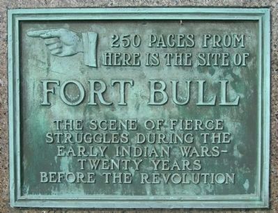
1. Fort Bull Marker
here is the site of
Fort Bull
the scene of fierce
struggles during the
early Indian Wars-
twenty years
before the revolution
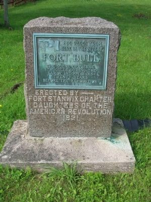
Erected 1921 by Fort Stanwix Chapter Daughters of the American Revolution.
Topics and series. This historical marker is listed in this topic list: War, French and Indian. In addition, it is included in the Daughters of the American Revolution (DAR) series list.
Location. 43° 13.589′ N, 75° 30.163′ W. Marker is in Rome, New York, in Oneida County. It is on Rome-New London Road (New York State Route 49) half a mile south of Rome-Taberg Road ( Route 69), on the right when traveling east. Marker is beside the driveway entrance to the Erie Canal Village. Touch for map. Marker is at or near this postal address: 5789 Rome-New London Road, Rome NY 13440, United States of America. Touch for directions.

Regionally, this marker is in Upstate New York and in the Mohawk Valley. It is also in the American Northeast and in the Mid-Atlantic. Globally, it is in North America, the Great North Woods, the Western Hemisphere,
this page online
Other nearby markers. At least 8 other markers are within 2 miles of this marker, measured as the crow flies: Erie Canal Enlargement (about 400 feet away, measured in a direct line); Clinton's Ditch (about 700 feet away); a different marker also named Fort Bull (approx. 0.2 miles away); Erie Canal (approx. ¼ mile away); Rome Cemetery (approx. 1.9 miles away); The Grave of Francis Bellamy (approx. 1.9 miles away); Francis Bellamy (approx. 1.9 miles away); U.S. Arsenal (approx. 1.9 miles away). Touch for a list and map of all markers in Rome.
Another marker is no longer nearby. The Erie Canal - July 4, 1817 (was within shouting distance of this marker but has been confirmed missing).
Regarding Fort Bull. In 1754, hostilities broke out in America between England and France which led to the French and Indian (or Seven Years) War. In 1755, the British built two small stockade forts at the Oneida Carry to safeguard the supply lines to
Photographed by Howard C. Ohlhous, August 17, 2008
2. Fort Bull Marker
Also see . . .
1. Fort Bull. New York State Military Museum and Veterans Research Center website entry (Submitted on June 4, 2011, by Howard C. Ohlhous of Duanesburg, New York.)
2. Erie Canal Village. Museum website homepage (Submitted on June 4, 2011, by Howard C. Ohlhous of Duanesburg, New York.)
Photographed by Howard C. Ohlhous, August 17, 2008
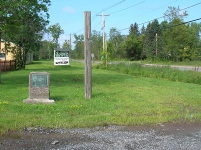
3. Fort Bull Marker

Photographed by Howard C. Ohlhous, August 17, 2008
4. Fort Bull Marker at Erie Canal Village Entrance
The Fort Bull Marker, in the background on the right, is at the entrance to the Erie Canal Village on Routes 46 & 49.
Photographed by Dale K. Benington, July 29, 2011
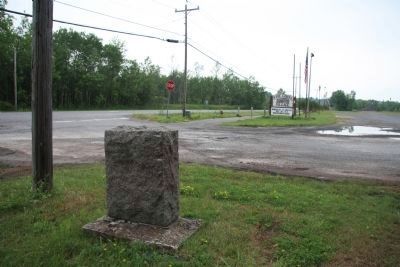
5. Fort Bull Marker
View looking east along Rome-New London Road, of the backside of the historical marker and of the entrance to the historic Erie Canal Village.

Photographed by Dale K. Benington, July 29, 2011
6. Fort Bull Marker
View of the historical marker in front of several structures that are part of the historic Erie Canal Village.
Credits. This page was last revised on October 23, 2021. It was originally submitted on June 4, 2011, by Howard C. Ohlhous of Duanesburg, New York. This page has been viewed 1,879 times since then and 25 times this year. Photos: 1, 2, 3, 4. submitted on June 4, 2011, by Howard C. Ohlhous of Duanesburg, New York. 5, 6. submitted on April 7, 2012, by Dale K. Benington of Toledo, Ohio. • Bernard Fisher was the editor who published this page.
