Old Lycoming Township near Williamsport in Lycoming County, Pennsylvania — The American Northeast (Mid-Atlantic)
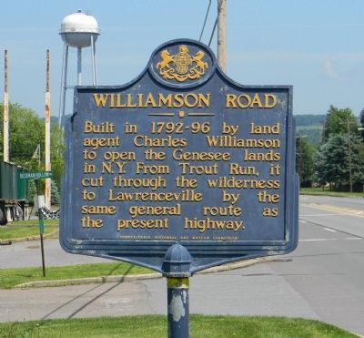
Williamson Road
Erected 1947 by Pennsylvania Historical and Museum Commission.
Topics and series. This historical marker is listed in these topic lists: Roads & Vehicles • Settlements & Settlers. In addition, it is included in the Pennsylvania Historical and Museum Commission series list.
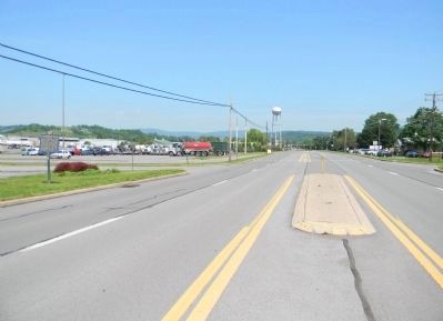
Location. 41° 17.307′ N, 77° 3.353′ W. Marker is near Williamsport, Pennsylvania, in Lycoming County. It is in Old Lycoming Township. Marker is at the intersection of Lycoming Creek Road (Old U.S. 15) and Deckman Hollow Road, on the right when traveling south on Lycoming Creek Road. Touch for map. Marker is in this post office area: Williamsport PA 17701, United States of America. Touch for directions.
Other nearby markers. At least 8 other markers are within 4 miles of this marker, measured as the crow flies. William Hepburn (approx. 2.7 miles away); John M. McMinn (approx. 2.7 miles away); Civil War Monument (approx. 2.9 miles away); Freedom Road Cemetery (approx. 3 miles away); Louise Larzelere Chatham (approx. 3.2 miles away); Bowman Field (approx. 3.3 miles away); Carl E. Stotz Field (approx. 3.4 miles away); Carl E. Stotz (approx. 3.4 miles away). Touch for a list and map of all markers in Williamsport.
Also see . . . History of Lycoming County, Chapter 48: The Williamson Road -- Susquehanna Trail. One of the most remarkable pieces of road construction ever attempted in this country and that, too, at a time when facilities for doing this kind of work were of the crudest character and most of it had to be done by hand, was the building of what was known as the "Williamson Road." (Submitted on June 8, 2011, by PaulwC3 of Northern, Virginia.)
Credits. This page was last revised on February 7, 2023. It was originally submitted on June 8, 2011, by PaulwC3 of Northern, Virginia. This page has been viewed 677 times since then and 42 times this year. Photos: 1, 2. submitted on June 8, 2011, by PaulwC3 of Northern, Virginia.

