White Deer Township near New Columbia in Union County, Pennsylvania — The American Northeast (Mid-Atlantic)
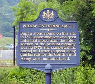
Widow Catherine Smith
Erected 1967 by Pennsylvania Historical and Museum Commission.
Topics and series. This historical marker is listed in these topic lists: Industry & Commerce • Patriots & Patriotism • War, US Revolutionary • Women. In addition, it is included in the Pennsylvania Historical and Museum Commission series list. A significant historical year for this entry is 1774.
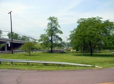
Location. 41° 4.517′ N, 76° 52.329′ W. Marker is near New Columbia, Pennsylvania, in Union County. It is in White Deer Township. Marker can be reached from the intersection of Leiser Road (Old U.S. 15) and Park Road (Pennsylvania Road 1010), on the left when traveling north. Touch for map. Marker is at or near this postal address: 1201 Leiser Rd, New Columbia PA 17856, United States of America. Touch for directions.
Other nearby markers. At least 8 other markers are within 4 miles of this marker, measured as the crow flies. Warrior Run Church (approx. 3.7 miles away); Col. Matthew Smith (approx. 3.8 miles away); Fort Freeland (approx. 3.8 miles away); a different marker also named Fort Freeland (approx. 3.8 miles away); Clinger Lumber Company / Kepler Brothers Trucking Company (approx. 3.9 miles away); The Hastings Printing Company (approx. 3.9 miles away); "Remembrance of Things Past" (approx. 3.9 miles away); The Milton Fair (approx. 3.9 miles away).
Also see . . .
1. Union County Historical Society: The Remarkable Widow Catherine Smith. (Submitted on June 10, 2011, by PaulwC3 of Northern, Virginia.)
2. Widow Smith's Walk. (Submitted on June 18, 2011, by PaulwC3 of Northern, Virginia.)
3. Widow Catherine Smith - Behind the Marker. ExplorePAHistory.com (Submitted on July 21, 2011, by Mike Wintermantel of Pittsburgh, Pennsylvania.)
Credits. This page was last revised on February 7, 2023. It was originally submitted on June 10, 2011, by PaulwC3 of Northern, Virginia. This page has been viewed 1,509 times since then and 46 times this year. Photos: 1, 2. submitted on June 10, 2011, by PaulwC3 of Northern, Virginia.
Editor’s want-list for this marker. Photo of Widow Smith stone house • Can you help?

