Near Fort Chiswell in Wythe County, Virginia — The American South (Mid-Atlantic)
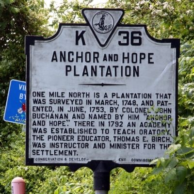
Anchor and Hope Plantation
Erected 1932 by Conservation & Development Commission. (Marker Number K-36.)
Topics and series. This historical marker is listed in these topic lists: Colonial Era • Settlements & Settlers. In addition, it is included in the Virginia Department of Historic Resources (DHR) series list. A significant historical month for this entry is March 1748.
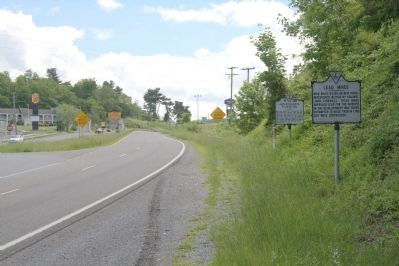
Location. 36° 56.653′ N, 80° 56.856′ W. Marker is near Fort Chiswell, Virginia, in Wythe County. Marker is at the intersection of U.S. 52 and Exit 80 (Interstate 81), on the right when traveling south on U.S. 52. Touch for map. Marker is in this post office area: Max Meadows VA 24360, United States of America. Touch for directions.
Other nearby markers. At least 8 other markers are within 7 miles of this marker, measured as the crow flies. Lead Mines (a few steps from this marker); Fort Chiswell (approx. 0.8 miles away); Wilderness Road (approx. 0.8 miles away); Fincastle County (approx. 4.8 miles away); Wythe County Poorhouse Farm (approx. 5.1 miles away); New River (approx. 6.1 miles away); To Mark The Site of The Lead Mines (approx. 6.1 miles away); Walter Crockett (approx. 6.2 miles away). Touch for a list and map of all markers in Fort Chiswell.
Credits. This page was last revised on December 27, 2023. It was originally submitted on June 12, 2011, by J. J. Prats of Powell, Ohio. This page has been viewed 1,797 times since then and 128 times this year. Last updated on December 25, 2023, by Carl Gordon Moore Jr. of North East, Maryland. Photos: 1, 2. submitted on June 12, 2011, by J. J. Prats of Powell, Ohio. • J. Makali Bruton was the editor who published this page.
Editor’s want-list for this marker. Photos of the plantation • Can you help?

