Perth Amboy in Middlesex County, New Jersey — The American Northeast (Mid-Atlantic)
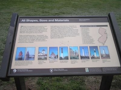
All Shapes, Sizes and Materials
Aids to Navigation
— Maritime History —
Today, each lighthouse has a “characteristic” or coded sequence of light flashes making it possible for the mariner to identify the light and its location along the coast. For example, Barnegat Light’s “Characteristic” was a flash every ten seconds at each point of the compass.
Each lighthouse tower also has a “daymark” or distinctive design and paint pattern. The yellow-black-yellow painted pattern on Absecon Lighthouse helped mariners to distinguish it from others. Some lighthouses, especially those located on dangerous shoals in the harbors and bays, are also equipped with fog signals to warn mariners of potential danger. What other unique characteristics and features help make each of New Jersey’s lighthouses distinctive?
Lighthouses of New Jersey
1. Sandy Hook Lighthouse
2. Robbins Reef Lighthouse
3. Romer Shoal Lighthouse
4. Twin Lights of Navesink
5. Conover Beacon
6. Great Beds Lighthouse
7. Chapel Hill Lighthouse
8. Sea Girt Lighthouse
9. Barnegat Lighthouse
10. Absecon Lighthouse
11. Hereford Inlet Lighthouse
12. Cape May Point Lighthouse
13. East Point Lighthouse
14. Finns Point Rear Range Lighthouse
15. Brandywine Shoal Lighthouse
16. Elbow of Cross Ledge Lighthouse
17. Miah Maull Shoal Lighthouse
18. Ship John Shoal Lighthouse
19. Tinicum Rear Range Lighthouse
Erected by State of New Jersey Division of Parks & Forestry and National Park System.
Topics and series. This historical marker is listed in this topic list: Waterways & Vessels. In addition, it is included in the Lighthouses series list. A significant historical year for this entry is 1852.
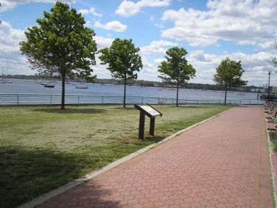
Location. 40° 29.985′ N, 74° 16.011′ W. Marker is in Perth Amboy, New Jersey, in Middlesex County. Marker is on Water Street, on the right when traveling north. Touch for map. Marker is in this post office area: Perth Amboy NJ 08861, United States of America. Touch for directions.
Other nearby markers. At least 8 other markers are within walking distance of this marker. Raritan Bay & New York Harbor (within shouting distance of this marker); Ambo Point (about 400 feet away, measured in a direct line); Inca Garcilaso de la Vega (about 500 feet away); Perth Amboy, NJ (about 600 feet away); Juan Pablo Duarte (about 600 feet away); Nicolaus Copernicus (about 600 feet away); Count Casimir Pulaski (about 600 feet away); The Water Highway (about 800 feet away). Touch for a list and map of all markers in Perth Amboy.
More about this marker. The upper right of the marker features a map of New Jersey showing the location of the 19 lighthouses listed on the marker. The bottom of the marker contains photographs of some of New Jersey’s lighthouses, including: Sandy Hook Lighthouse, Gateway NRA; Absecon Lighthouse, Atlantic City; Cape May Lighthouse, Cape May; Navesink Twin Lights Lighthouse, Highlands; Barnegat Lighthouse, Long Beach Island; East Point Lighthouse, Heislerville; Hereford Inlet Lighthouse, North Wildwood; and Miah Maull & Ship John shoal lights, Sea Breeze & Fortesque. The caption indicates that “Some navigational aids, especially those located on dangerous shoals, are also equipped with fog signals.”
Also see . . . New Jersey Coastal Heritage Trail Route. National Park Service website. (Submitted on June 16, 2011, by Bill Coughlin of Woodland Park, New Jersey.)
Credits. This page was last revised on June 16, 2016. It was originally submitted on June 15, 2011, by Bill Coughlin of Woodland Park, New Jersey. This page has been viewed 527 times since then and 7 times this year. Photos: 1, 2. submitted on June 15, 2011, by Bill Coughlin of Woodland Park, New Jersey.

