İsa Bey in Selçuk, İzmir, Turkey — West Asia or Southeast Europe
St. Jean (Aziz Yahya) Kilisesi / The Church of St. John
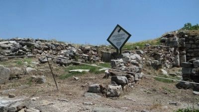
Inscription.
[Left column: text in Turkish]
[Right column: text in English]
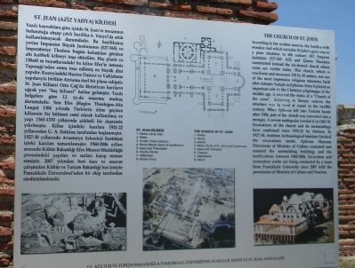
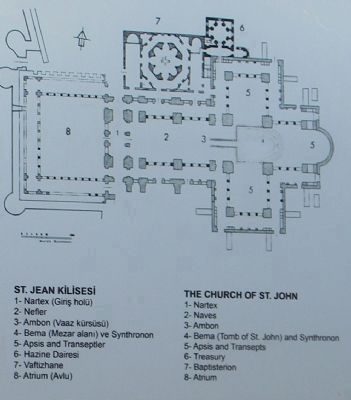
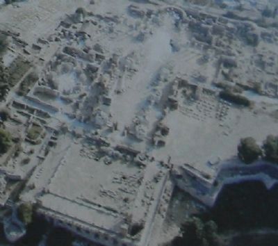
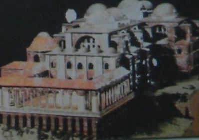
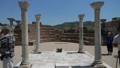
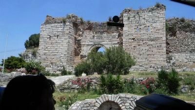
According to the written sources, the basilica with wooden roof which includes St. Johns grave was in a poor situation in 6th century AD. Emperor Justinian (527565 AD) and Queen Theodora constructed instead the six-domed church whose ruins are visible today. This church, which is cruciform and measures 130 by 65 meters, was one of the most impressive religious structures built after Artemis Temple in Ephesus. Since it played an important role in the Christian pilgrimages of the middle age, it attained the status of a Church of the cross. According to literary sources, the structure was in need of repair in the twelfth century. When Ephesus fell into Turkish hands after 1304, part of the church was converted into a mosque. A severe earthquake leveled it in 1365-70. Excavations of the church and its surrounding have continued since 1921-22 by Sotiriou. In 1927-30, Austrian Archaeological Institute finished the excavations inside. Ephesus Museum Directorate of Ministry of Culture excavated and restored the surrounding buildings and fortifications between 1960-2006. Excavation and restoration works are being conducted by a team from Pamukkale University since 2007 with the permission of Ministry of Culture and Tourism.
Erected by T.C. Kültür Ve Turizm Bakanliği & Pamukkale Üniversitesi Ayasuluk Tepesi Ve St. Jean Aniti Kazisi.
Topics. This historical marker is listed in these topic lists: Cemeteries & Burial Sites • Churches & Religion. A significant historical year for this entry is 1304.
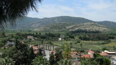
Location. 37° 57.156′ N, 27° 22.066′ E. Marker is in Selçuk, İzmir. It is in İsa Bey. Marker can be reached from St. Jean Caddisi west of 2013 Sokak. Marker is on the grounds of the Basilica of St. John site, mounted among the ruins near the ancient church's north apse. Touch for map. Marker is in this post office area: Selçuk, İzmir 35920, Turkey. Touch for directions.
Other nearby markers. At least 8 other markers are within 3 kilometers of this marker, measured as the crow flies. St. Jean'in (Aziz Yahya) Kimliği Ve Hayatı/The Life of St. John (a few steps from this marker); The Basilica of St. John (about 90 meters away, measured in a direct line); Hellenistic Fountain House (approx. 2.6 kilometers away); The Great Theatre (approx. 2.6 kilometers away); Ancient Ephesos (approx. 2.7 kilometers away); Byzantine Ephesos (approx. 2.7 kilometers away); Roman Ephesos (approx. 2.7 kilometers away); The Hellenistic Ephesos (approx. 2.7 kilometers away). Touch for a list and map of all markers in Selçuk.
Additional keywords. archaeology; Ayasuluk; Ayasoluk Hill
Credits. This page was last revised on November 26, 2023. It was originally submitted on June 24, 2011, by Richard E. Miller of Oxon Hill, Maryland. This page has been viewed 1,770 times since then and 90 times this year. Photos: 1, 2, 3, 4, 5, 6, 7, 8. submitted on June 24, 2011, by Richard E. Miller of Oxon Hill, Maryland. • Bernard Fisher was the editor who published this page.
