Green Bay in Brown County, Wisconsin — The American Midwest (Great Lakes)
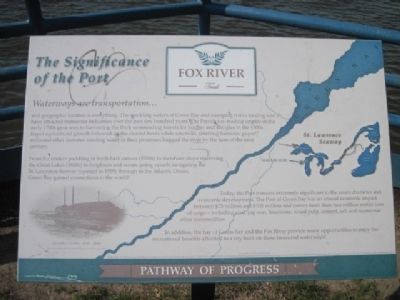
The Significance of the Port
Waterways are transportation...
| — | Fox River Trail | — |
Photographed by Robert L Weber, June 9, 2011
1. The Significance of the Port Marker
and geographic location is everything. The sparkling waters of Green Bay and sweeping rivers feeding into it have attracted numerous industries over the past few hundred years. The French fur-trading empire of the early 1700s gave way to harvesting the thick surrounding forests for lumber and shingles in the 1800s. Rapid agriculture growth followed on the cleared lands while sawmills, smelting furnaces, paper mills and other factories needing water in their processes hugged the river by the turn of the next century.
From fur traders paddling in birch bark canoes (1700s) to merchant ships traversing the Great Lakes (1800s) to freighters and ocean-going vessels navigating the St. Lawrence Seaway (opened in 1959) through to the Atlantic Ocean, Green Bay gained connections to the world!
Today, the Port remains extremely significant to the area's character and economic development. The Port of Green Bay has an annual economic impact between $75 million and $100 million and moves more than two million metric tons of cargo - including coal, pig iron, limestone, wood pulp, cement, salt and numerous other commodities.
In
this page online
Topics. This historical marker is listed in these topic lists: Notable Places • Waterways & Vessels.
Location. 44° 31.224′ N, 88° 0.541′ W. Marker is in Green Bay, Wisconsin, in Brown County. It can be reached from the intersection of North Jefferson Street and Utility Street. Located at the confluence of the Fox River and the East River on the Fox River Trail. Touch for map. Marker is in this post office area: Green Bay WI 54301, United States of America. Touch for directions.

Regionally, this marker is in the Fox River Valley. It is also in the American Midwest and in the Corn Belt. Globally, it is in North America, on the Great Lakes, in the Western Hemisphere, in the Western World, and in the Anglosphere. Historically, it finds itself in what was once the Viceroyalty of New France, the territory of the Mississippian Culture, and the Northwest Territory.
Other nearby markers. At least 8 other markers
Photographed by Robert L Weber, June 9, 2011
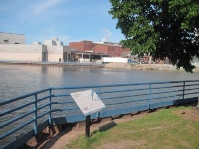
2. Marker, Fox River and Paper Mill.
Another marker is no longer nearby. September 11, 2001 Memorial (was approx. 0.4 miles away but has been permanently removed).
Related markers. Click here for a list of markers that are related to this marker.
Also see . . . Fox River Trail. (Submitted on June 27, 2011, by Bernard Fisher of Richmond, Virginia.)
Photographed by Robert L Weber, June 9, 2011
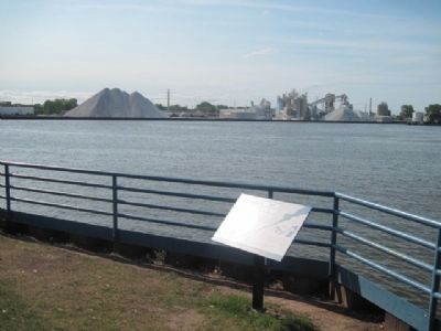
3. Marker, Fox River and Salt Piles.
Photographed by Robert L Weber, June 9, 2011
4. Marker, Fox River and Paper Mill.
Credits. This page was last revised on June 16, 2016. It was originally submitted on June 23, 2011, by Bob (peach) Weber of Dewey, Arizona. This page has been viewed 869 times since then and 26 times this year. Last updated on June 27, 2011, by Bob (peach) Weber of Dewey, Arizona. Photos: 1, 2, 3, 4. submitted on June 23, 2011, by Bob (peach) Weber of Dewey, Arizona. • Bernard Fisher was the editor who published this page.
