Near Camptonville in Sierra County, California — The American West (Pacific Coastal)
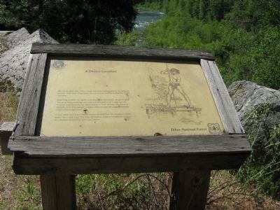
A Choice Location
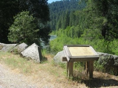
Beginning in 1849, the North Yuba River was intensively mined for gold. The cone shaped tailings you may see along the river’s edge are the result of dragline dredging, which ended in 1941. Stores, ranches and sawmills were also located in Indian Valley to provide support services to the surrounding miners.
In the 1930s the Forest Service began development of campgrounds for public use in this area. This was, and still is, a place for families to have an inexpensive vacation and enjoy nature.
Erected by United States Forest Service - Tahoe National Forest.
Topics. This historical marker is listed in these topic lists: Native Americans • Waterways & Vessels. A significant historical year for this entry is 1849.
Location. 39° 30.991′ N, 120° 59.185′ W. Marker is near Camptonville, California, in Sierra County. Marker is on State Highway 49, on the right when traveling north. Marker is located .1 mile north of the Fiddle Creek Campground. Touch for map. Marker is in this post office area: Camptonville CA 95922, United States of America. Touch for directions.
Other nearby markers. At least 8 other markers are within 6 miles of this marker, measured as the crow flies. Plum Valley House Site (approx. 4.9 miles away); Henness Pass Road - Plum Valley (approx. 4.9 miles away); Mountain House (approx. 5.3 miles away); Capt. Brown House (approx. 5˝ miles away); Mountain Range Lodge No. 18, F. & A. M. (approx. 5.6 miles away); The St. Charles Hotel (approx. 5.6 miles away); Goodyears Bar (approx. 5.6 miles away); William Bull Meek (approx. 5.6 miles away). Touch for a list and map of all markers in Camptonville.
Credits. This page was last revised on June 16, 2016. It was originally submitted on June 28, 2011, by Syd Whittle of Mesa, Arizona. This page has been viewed 742 times since then and 41 times this year. Photos: 1, 2, 3. submitted on June 28, 2011, by Syd Whittle of Mesa, Arizona.


