Finzel in Garrett County, Maryland — The American Northeast (Mid-Atlantic)
Savage River Camp

General Braddock's 3rd camp on his march to Fort Duquesne June 16, 1755. The route, later known as the Old Braddock Road, passes to the southeast of the National Road. Captain Orme's diary says "we entirely demolished three wagons and shattered several" descending Savage Mountain.
Erected by Maryland State Highway Administration.
Topics and series. This historical marker is listed in this topic list: War, French and Indian. In addition, it is included in the Braddock’s Road and Maj. Gen. Edward Braddock, and the Maryland Historical Trust series lists. A significant historical date for this entry is June 16, 1797.
Location. 39° 41.262′ N, 78° 58.325′ W. Marker is in Finzel, Maryland, in Garrett County. It is at the intersection of National Road (Alternate U.S. 40) and Finzel Road, on the right when traveling west on National Road. Marker is just east of the I-68 Finzel Road exit. Touch for map. Marker is in this post office area: Frostburg MD 21532, United States of America. Touch for directions.

Regionally, this marker is in Western Maryland. It is also in the American Mid-Atlantic, in Appalachia, and specifically in Northern
this page online
Other nearby markers. At least 5 other markers are within 3 miles of this marker, measured as the crow flies: Historic Braddock Road (approx. 1½ miles away); The Long Stretch (approx. 1.7 miles away); Dickerson AME Church (approx. 2.9 miles away); The Memorial Window (approx. 3 miles away); Frostburg (approx. 3.1 miles away).
Another marker is no longer nearby. Blazing Braddock's Road (was approx. 1.1 miles away but has been confirmed missing).
Also see . . . Historians walk Braddock's Road 250 years later. Pittsburgh Post-Gazette website entry (Submitted on July 16, 2006.)
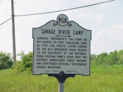
Photographed by J. J. Prats, June 7, 2006
2. Savage River Camp Marker
This is a previous iteration of the marker. Note that the erecting organization name is the State Roads Commission, which is a prior name for the Maryland State Highway Administration.

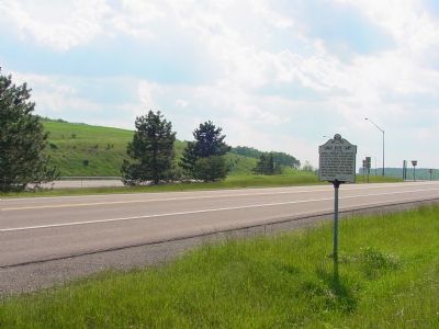
Photographed by J. J. Prats, June 7, 2006
4. Savage River Camp Marker
Credits. This page was last revised on March 29, 2026. It was originally submitted on July 16, 2006, by J. J. Prats of Powell, Ohio. This page has been viewed 3,919 times since then and 99 times this year. Photos: 1. submitted on March 29, 2026, by Devry Becker Jones of Washington, District of Columbia. 2. submitted on July 16, 2006, by J. J. Prats of Powell, Ohio. 3. submitted on March 29, 2026, by Devry Becker Jones of Washington, District of Columbia. 4. submitted on July 16, 2006, by J. J. Prats of Powell, Ohio.
