Concordia in Lafayette County, Missouri — The American Midwest (Upper Plains)
Massacre Site / Concordia
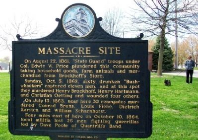
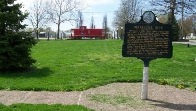
Side A: Massacre Site
On August 22, 1861, "State Guard" troops under Col. Edwin W. Price plundered this community taking household goods, farm animals and merchandise from Brockhoff's Store.
Sunday, Oct. 5, 1862, sixty drunken "Bushwhackers" captured eleven men, and at this spot they murdered Henry Brockhoff, Henry Hartmann, and Christian Oetting and wounded four others.
On July 13, 1863, near here 35 renegades murdered Conrad Bruns, Louis Fiene, Dietrich Karsten and William Scharnhorst.
Four miles east of here on October 10, 1864, local militia lost 26 men fighting guerrillas led by Dave Poole of Quantrill's Band.
see other side
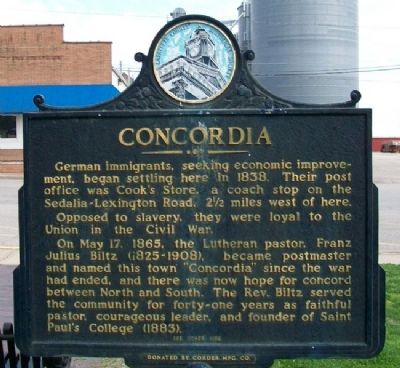
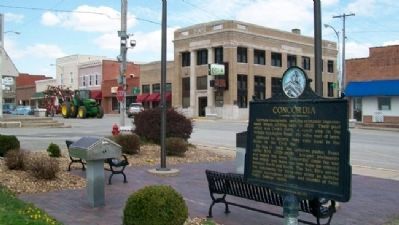
Side B: Concordia
German immigrants, seeking economic improvement, began settling here in 1838. Their post office was Cook's Store, a coach stop on the Sedalia-Lexington Road, 2 1/2 miles west of here.
Opposed to slavery, they were loyal to the Union in the Civil War.
On May 17, 1865, the Lutheran pastor, Franz Julius Biltz (1825-1908), became postmaster and named this town "Concordia" since the war had ended, and there was now hope for concord between North and South. The Rev. Biltz served the community for forty-one years as faithful pastor, courageous leader, and founder of Saint Paul's College (1883).
see other side
Erected by Corder Manufacturing Company and Lafayette County Historical Society.
Topics and series. This historical marker is listed in these topic lists: Churches & Religion • Patriots & Patriotism • Settlements & Settlers • War, US Civil. In addition, it is included in the Historically Black Colleges and Universities series list. A significant historical date for this entry is May 17, 1865.
Location. 38° 58.976′ N, 93° 34.109′ W. Marker is in Concordia, Missouri, in Lafayette County. Marker is at the intersection of Main Street (Missouri Route 23) and SW 6th Street, on the right when traveling south on Main Street. Marker is along the eastern edge of Central Park. Touch for map. Marker is in this post office area: Concordia MO 64020, United States of America. Touch for directions.
Other nearby markers. At least 8 other markers are within walking distance of this marker. Veterans War Memorial (here, next to this marker); Lions Club Clock Tower (within shouting distance of this marker); Concordia Veterans Memorial (within shouting distance of this marker); Missouri Pacific Caboose (within shouting distance of this marker); Replica of the Statue of Liberty (about 300 feet away, measured in a direct line); Wilk School Bell (about 700 feet away); St. Paul's College (approx. 0.3 miles away); Civil War Casualties (approx. half a mile away). Touch for a list and map of all markers in Concordia.
Also see . . .
1. Concordia, Missouri. Wikipedia entry (Submitted on January 9, 2024, by Larry Gertner of New York, New York.)
2. Missouri in the American Civil War. Wikipedia entry (Submitted on January 9, 2024, by Larry Gertner of New York, New York.)
Credits. This page was last revised on January 9, 2024. It was originally submitted on June 30, 2011, by William Fischer, Jr. of Scranton, Pennsylvania. This page has been viewed 2,042 times since then and 107 times this year. Photos: 1, 2, 3, 4. submitted on June 30, 2011, by William Fischer, Jr. of Scranton, Pennsylvania.


