Oxford Township near New Oxford in Adams County, Pennsylvania — The American Northeast (Mid-Atlantic)
Gettysburg Campaign
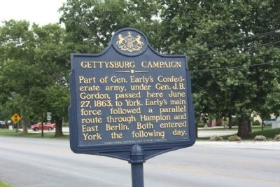
Photographed by Mike Stroud, 2011
1. Gettysburg Campaign Marker
Erected 1947 by Pennsylvania Historical and Museum Commission.
Topics and series. This historical marker is listed in this topic list: War, US Civil. In addition, it is included in the Gettysburg Campaign, and the Pennsylvania Historical and Museum Commission (PHMC) series lists. A significant historical month for this entry is June 1790.
Location. 39° 52.188′ N, 77° 1.87′ W. Marker is near New Oxford, Pennsylvania, in Adams County. It is in Oxford Township. It is on York Road (U.S. 30) near Village Drive when traveling east. Located just west of Carlisle Pike (State Route 94), east of New Oxford. Touch for map. Marker is in this post office area: New Oxford PA 17350, United States of America. Touch for directions.

Regionally, this marker is in South-Central Pennsylvania. It is also in the American Northeast, in the Mid-Atlantic, in Appalachia, and specifically in Northern Appalachia. Globally, it is in North
this page online
Other nearby markers. At least 8 other markers are within 2 miles of this marker, measured as the crow flies: New Oxford (approx. one mile away); Fill 'Er Up (approx. one mile away); New Oxford Veterans Memorial (approx. 1.4 miles away); Theo. Pfeiffer (approx. 1.4 miles away); World War II Veterans of New Oxford (approx. 1.4 miles away); Kuhn Tavern (approx. 1.4 miles away); Building the Highway (approx. 1.4 miles away); Road Versus Rail (approx. 1.6 miles away). Touch for a list and map of all markers in New Oxford.
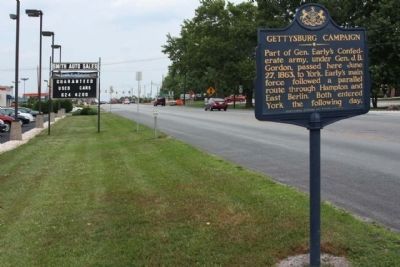
Photographed by Mike Stroud, June 18, 2011
2. Gettysburg Campaign Marker, looking east along York Road (US 30)
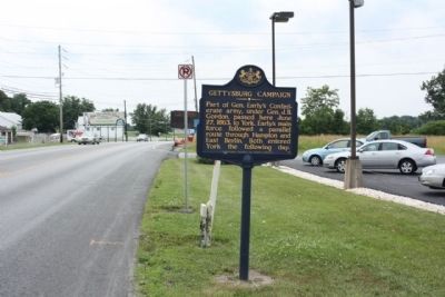
Photographed by Mike Stroud, June 18, 2011
3. Gettysburg Campaign Marker, looking west
Credits. This page was last revised on February 7, 2023. It was originally submitted on July 1, 2011, by Mike Stroud of Bluffton, South Carolina. This page has been viewed 1,390 times since then and 33 times this year. Photos: 1, 2, 3. submitted on July 1, 2011, by Mike Stroud of Bluffton, South Carolina.
