Near Covesville in Nelson County, Virginia — The American South (Mid-Atlantic)
Nelson County / Albemarle County
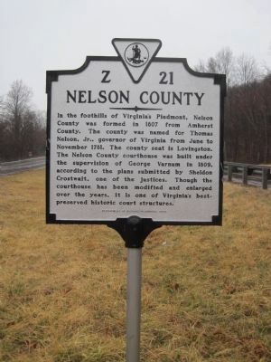
Nelson County. In the foothills of Virginia’s Piedmont, Nelson County was formed in 1807 from Amherst County. The county was named for Thomas Nelson, Jr., governor of Virginia from June to November 1781. The county seat is Lovingston. The Nelson County courthouse was built under the supervision of George Varnum in 1809, according to the plans submitted by Sheldon Crostwait, one of the justices. Though the courthouse has been modified and enlarged over the years, it is one of Virginia’s best-preserved historic court structures.
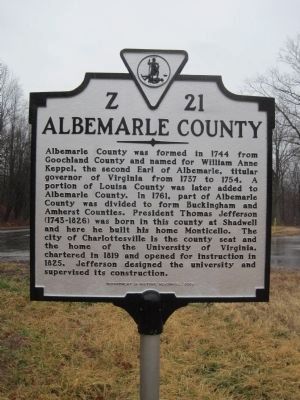
Albemarle County. Albemarle County was formed in 1744 from Goochland County and named for William Anne Keppel, the second Earl of Albemarle, titular governor of Virginia from 1737 to 1754. A portion of Louisa County was later added to Albemarle County. In 1761, part of Albemarle County was divided to form Buckingham and Amherst Counties. President Thomas Jefferson (1743–1826) was born in this county at Shadwell and here he built his home Monticello. The city of Charlottesville is the county seat and the home of the University of Virginia, chartered in 1819 and opened for instruction in 1825. Jefferson designed the university and supervised its construction.
Erected 2009 by Department of Historic Resources. (Marker Number Z-21.)
Topics and series. This historical marker is listed in these topic lists: Colonial Era • Education • Political Subdivisions • Settlements & Settlers. In addition, it is included in the Former U.S. Presidents: #03 Thomas Jefferson, and the Virginia Department of Historic Resources (DHR) series lists. A significant historical month for this entry is November 1781.
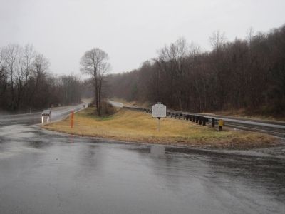
Location. 37° 51.86′ N, 78° 44.047′ W. Marker is near Covesville, Virginia, in Nelson County. Marker is on Thomas Nelson Highway (U.S. 29) east of State Route 6, on the right when traveling west. Touch for map. Marker is in this post office area: Covesville VA 22931, United States of America. Touch for directions.
Other nearby markers. At least 8 other markers are within 10 miles of this marker, measured as the crow flies. Boyhood Home of Colonel John Mosby (approx. 2.3 miles away); Covesville Apple Industry (approx. 2.4 miles away); Hurricane Camille (approx. 4.7 miles away); Rockfish Church (approx. 6.9 miles away); North Garden Church (approx. 7.6 miles away); William H. Crawford (approx. 7.8 miles away); Staunton and James River Turnpike (approx. 9.1 miles away); a different marker also named Hurricane Camille (approx. 9.6 miles away).
More about this marker. This marker replaced a marker with the same titles and number dating back to the late 1920s or early 1930s. The inscriptions on that previous marker read:
Nelson County. Area 473 square miles. Formed in 1807 from Amherst, and named for General Thomas Nelson, governor of Virginia, 1781. Oak Ridge, old home, is in this county.
Albemarle County. Area 751 square miles. Formed in 1744 from Goochland, and named for the Earl of Albemarle, titular governor of Virginia, 1737–1754. In 1781, Albemarle was divided and Buckingham and Amherst formed, and a part of Louisa was added to Albemarle. Thomas Jefferson was born in this county and lived in it.
Credits. This page was last revised on February 2, 2023. It was originally submitted on July 2, 2011, by Kevin W. of Stafford, Virginia. This page has been viewed 835 times since then and 26 times this year. Photos: 1, 2, 3. submitted on July 2, 2011, by Kevin W. of Stafford, Virginia.


