McDonough in Henry County, Georgia — The American South (South Atlantic)
The Right Wing at McDonough
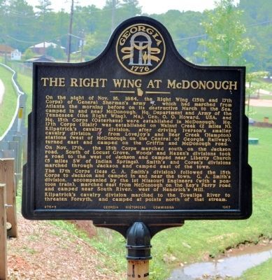
Photographed by David Seibert, July 2, 2011
1. The Right Wing at McDonough Marker
The 17th Corps (less G.A. Smith’s division) followed the 15th Corps to Jackson and camped in and near the town. G.A. Smith´s division, accompanied by
this page online
Erected 1957 by Georgia Historical Commission. (Marker Number 075-5.)
Topics and series. This historical marker is listed in this topic list: War, US Civil. In addition, it is included in the Georgia Historical Society, and the Sherman’s March to the Sea series lists. A significant historical date for this entry is October 16, 1861.
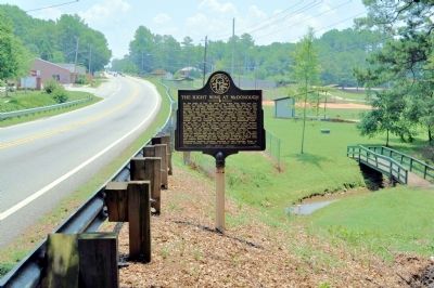
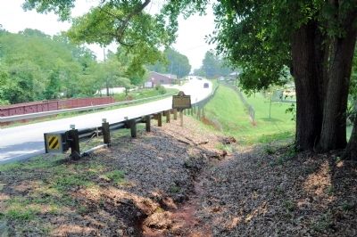
Location. 33° 27.354′ N, 84° 9.11′ W. Marker is in McDonough, Georgia, in Henry County. It is at the intersection of Atlanta Street (U.S. 23) and Park Circle, on the right when traveling south on Atlanta Street. The marker stands at the exit of a city park at the north edge of McDonough. Touch for map. Marker is in this post office area: McDonough GA 30253, United States of America. Touch for directions.

Regionally, this marker is in Georgia’s Piedmont and in Metro Atlanta. It is also in the American South and specifically
Photographed by David Seibert, July 2, 2011
2. The Right Wing at McDonough Marker
Looking south on Atlanta Street (US 23) toward downtown McDonough
Other nearby markers. At least 8 other markers are within 2 miles of this marker, measured as the crow flies: Camp Creek Train Wreck (approx. 0.6 miles away); Henry County (approx. 0.6 miles away); Henry County Courthouse (approx. 0.6 miles away); Henry County Sons Lost in Vietnam (approx. 0.7 miles away); McDonough Square (approx. 0.7 miles away); "Flame of Freedom" (approx. 0.7 miles away); The Brown House (approx. ¾ mile away); Ola Schoolhouse (approx. 2 miles away). Touch for a list and map of all markers in McDonough.
Photographed by David Seibert, July 2, 2011
3. The Right Wing at McDonough Marker
Credits. This page was last revised on February 1, 2021. It was originally submitted on July 3, 2011, by David Seibert of Sandy Springs, Georgia. This page has been viewed 1,583 times since then and 49 times this year. Photos: 1, 2, 3. submitted on July 3, 2011, by David Seibert of Sandy Springs, Georgia. • Craig Swain was the editor who published this page.
