
Reno in Washoe County, Nevada — The American Mountains (Southwest)
Lake's Crossing
Photographed by Barry Swackhamer, June 13, 2011
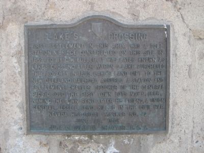
1. Lake's Crossing Marker
First settlement in this area was a toll station & bridge constructed on this site in 1859-60 by E.W. Fuller. It was later known as Lake’s Crossing after Myron C. Lake purchased this property in 1863. Lake’s land gift to the new overland railroad assured a station and settlement. Charles Crocker of the Central Pacific sold the first town lots May 9, 1868, naming the town Reno after his friend, a Union general, Jesse L. Reno, killed in the Civil War.
Erected 1968 by Julia C. Bulette Chapter, E Campus Vitus. (Marker Number 42.)
Topics and series. This historical marker is listed in these topic lists: Bridges & Viaducts • Settlements & Settlers • Waterways & Vessels. In addition, it is included in the E Clampus Vitus series list. A significant historical month for this entry is May 1836.
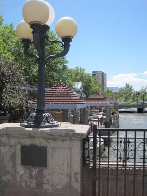
Location. 39° 31.494′ N, 119° 48.751′ W. Marker is in Reno, Nevada, in Washoe County. It is on South Virgina Street (Nevada Route 430), on the right when traveling south. The marker is located on the west side of the south end of the Virginia Street Bridge over the Truckee River. Touch for map. Marker is in this post office area:
this page online

Regionally, this marker is in the Sierra Nevada and in the Lake Tahoe Basin. It is also in the American Mountain West. Globally, it is in North America, the Western Hemisphere, the Western World, and the Anglosphere. Historically, it finds itself in what was once New Spain and also Mexico’s Alta California.
Other nearby markers. At least 8 other markers are within walking distance of this marker: Site of Nevada’s First Public Library (within shouting distance of this marker); Frederick Joseph DeLongechamps (within shouting distance of this marker); The Virginia Street Bridges (within shouting distance of this marker); Ginsburg Jewelry Company (about 300 feet away, measured in a direct line); Reno (about 300 feet away); Washoe County World War II Memorial (about 300 feet away); Reno's Beginning (about 500 feet away); Spanish-American War Memorial 1898-1899 (about 500 feet away). Touch for a list and map of all markers in Reno.
Photographed by Barry Swackhamer, June 13, 2011
2. Lake's Crossing Marker
Photographed by Barry Swackhamer, June 13, 2011
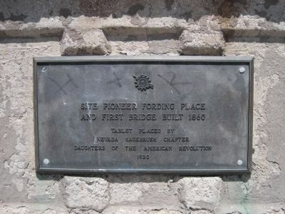
3. An additional marker on the Virginia Street Bridge.
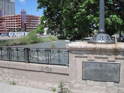
This marker is opposite the Lake's Crossing marker on the east side of the south end of the Virginia Street Bridge.
The text:Site pioneer fording place and first bridge built 1860
Tablet place by Nevada Sagebrush Chapter Daughter of the American Revolution 1930
Photographed by Barry Swackhamer, June 13, 2011
4. The D.A.R Marker on the Virginia Street Bridge.
Credits. This page was last revised on March 9, 2026. It was originally submitted on July 5, 2011, by Barry Swackhamer of Brentwood, California. This page has been viewed 2,952 times since then and 210 times this year. Photos: 1, 2, 3, 4. submitted on July 5, 2011, by Barry Swackhamer of Brentwood, California. • Syd Whittle was the editor who published this page.
