Near Brandy Station in Culpeper County, Virginia — The American South (Mid-Atlantic)
The Battle of Brandy Station
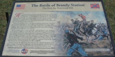
The Race for Fleetwood Hill
Stuart was surprised when word came of a Federal attack on his outposts at Beverly Ford at first light on June 9. He sent his headquarters wagons off to Culpeper Court House and responded swiftly to Brig. Gen. John Buford's Union challenge. The strong line Stuart established near St. James Church began pushing back the Federals by late morning.
But a second surprise - and near disaster - arrived about 11 a.m. Another Union division, 2,200 men under Brig. Gen. David M. Gregg, had crossed the river at Kelly's Ford with minimal opposition and appeared in Stuart's rear. A quick-thinking Confederate staff officer opened fire with a solitary cannon from the crest of Fleetwood Hill on the Federal troopers exiting the village of Brandy Station. Meanwhile, couriers dashed off to Stuart, then a mile away near St. James Church. Stuart acted decisively. Pulling his regiments from the St. James Church area, he sent them galloping for Fleetwood Hill.
It was a race for the high ground, but Stuart's men reached the grassy crest before Gregg's. Pouring down on the other side, the Confederates hit Col. Percy Wyndham's Union cavalry brigade hard, blunting the first Federal attack.
The Hallowell Foundation generously contributed toward the interpretation of this site in memory of Carrington Williams.
Help Preserve Battlefields • call CWPT at 1-888-606-1400 • www.civilwar.org
This material is based upon work assisted by a grant from the Department of the Interior, National Park Service. Any opinion, findings and conclusions or recommendations expressed in this material are those of the author(s) and do not necessarily reflect the views of the Department of the Interior.
Erected by Civil War Preservation Trust.
Topics. This historical marker is listed in this topic list: War, US Civil. A significant historical date for this entry is June 8, 1711.
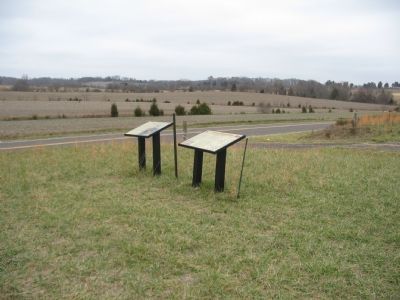
Location. This marker has been replaced by another marker nearby. It was located near 38° 30.45′ N, 77° 53′ W. Marker was near Brandy Station, Virginia, in Culpeper County. Marker was on Fleetwood Heights Road (County Route 685), on the right when traveling east. Located on
Other nearby markers. At least 8 other markers are within walking distance of this location. A different marker also named Battle of Brandy Station (a few steps from this marker); a different marker also named Battle of Brandy Station (a few steps from this marker); a different marker also named Battle of Brandy Station (approx. ¼ mile away); a different marker also named Battle of Brandy Station (approx. ¼ mile away); a different marker also named Battle of Brandy Station (approx. ¼ mile away); a different marker also named Battle of Brandy Station (approx. ¼ mile away); a different marker also named Battle of Brandy Station (approx. ¼ mile away); a different marker also named Battle of Brandy Station (approx. ¼ mile away). Touch for a list and map of all markers in Brandy Station.
More about this marker. On the right side of the marker "The valiant charge of the 35th Virginia Cavalry is depicted in The Gray Comanches by Don Troiani, courtesy of Historical Art Prints, Ltd."
Regarding The Battle of Brandy Station. This is one of several markers interpreting the Battle of Brandy Station and the winter encampments of 1863-64 in Culpeper County. See the Battle of Brandy Station Virtual
Tour by Markers linked below for additional related markers.
Related marker. Click here for another marker that is related to this marker. New Marker at this Location titled "Battle of Brandy Station: Suprise — First at Beverly Ford and Again in Brandy Station"
Also see . . .
1. Battle of Brandy Station. National Park Service summary of the battle includes a driving tour. (Submitted on December 30, 2007, by Craig Swain of Leesburg, Virginia.)
2. Brandy Station Foundation. Through the efforts of the Brandy Station Foundation, Civil War Preservation Trust, and other organizations, over 960 acres of this battlefield have been preserved. (Submitted on December 30, 2007, by Craig Swain of Leesburg, Virginia.)
3. Brandy Station. Civil War Preservation Trust page on the battle. (Submitted on December 30, 2007, by Craig Swain of Leesburg, Virginia.)
4. Battle of Brandy Station Virtual Tour by Markers. A set markers that document the Battle of Brandy Station, June 9, 1863, and the Winter Encampment of 1863-64. Note the order of appearance is geographic and not chronologically aligned to the battle. (Submitted on January 1, 2008, by Craig Swain of Leesburg, Virginia.)
Photographed By Craig Swain, December 22, 2007
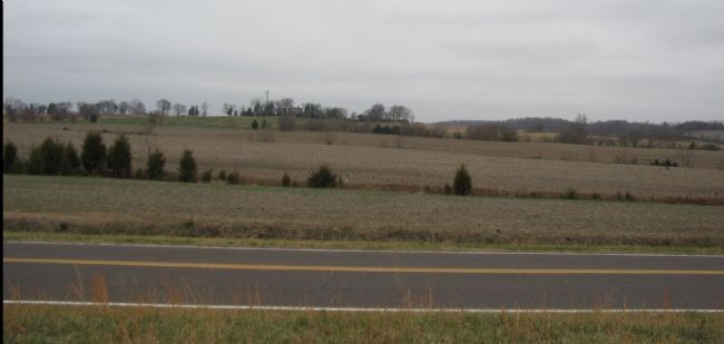
4. Beauregard or Barbour House
General Robert E. Lee observed a portion of the battle from the Barbour House (on the hill in the center) to the west of Fleetwood Hill. In the open fields in the foreground, Federal and Confederate cavalry charged and counter-charged in this phase of the battle.
Photographed By Craig Swain, December 22, 2007
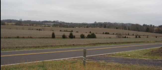
5. Stuart's Final Line
Pressed by Buford and Gregg, Stuart formed his final line along Fleetwood Hill. While Brig. Gen. William "Grumble" Jones' Brigade raced to the crest of Fleetwood Hill (out of frame to the right), Brig. Gen. Wade Hampton's Brigade fell back to the side of the hill to the north of the Carolina Road (high ground in the background of this photo). Beckham's artillery was quickly repositioned along the hillside to fire upon the Federals as they attacked the hill.
Credits. This page was last revised on January 7, 2024. It was originally submitted on December 30, 2007, by Craig Swain of Leesburg, Virginia. This page has been viewed 2,834 times since then and 19 times this year. Photos: 1. submitted on December 30, 2007, by Craig Swain of Leesburg, Virginia. 2. submitted on March 13, 2009, by Craig Swain of Leesburg, Virginia. 3, 4, 5. submitted on December 30, 2007, by Craig Swain of Leesburg, Virginia.
