Cambridge in Middlesex County, Massachusetts — The American Northeast (New England)
Old Charlestown – Watertown Path
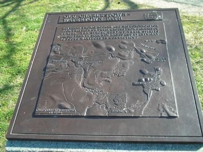
Reverend Thomas Hooker and his congregation took this path on their exodus from Cambridge in 1636. The strong bent of their spirits caused them to seek new lands and eventually to found Hartford in Connecticut.
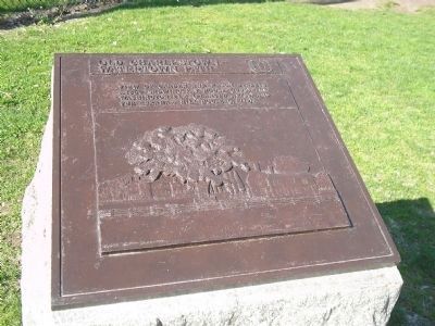
second marker:
View of Garden and Mason Streets c. 1860 showing Fay House (1806), the Washington Elm (planted c. 1700) and the Abraham Hill House (c. 1718).
Topics. This historical marker is listed in this topic list: Colonial Era. A significant historical year for this entry is 1636.
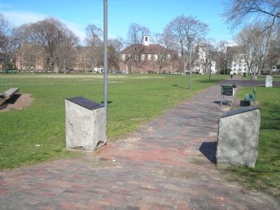
Location. 42° 22.593′ N, 71° 7.306′ W. Marker is in Cambridge, Massachusetts, in Middlesex County. Marker is on Garden Street, on the right when traveling west. Marker is located on the Cambridge Common. Touch for map. Marker is in this post office area: Cambridge MA 02138, United States of America. Touch for directions.
Other nearby markers. At least 8 other markers are within walking distance of this marker. Gen. Henry Knox Trail (a few steps from this marker); Washington Elm (within shouting distance of this marker); Prince Hall Memorial (within shouting distance of this marker); Washington’s General Orders (within shouting distance of this marker); Gen. Casimir Pulaski (within shouting distance of this marker); These Cannon Were Abandoned (within shouting distance of this marker); Gen. Thaddeus Kosciuszko (within shouting distance of this marker); Cambridge Soldiers and Sailors Monument (about 400 feet away, measured in a direct line). Touch for a list and map of all markers in Cambridge.
More about this marker. The first marker contains a bas relief map of Cambridge and Environs in 1640. The second features a relief of the view described on marker 2.
Credits. This page was last revised on March 4, 2022. It was originally submitted on May 11, 2011, by Bill Coughlin of Woodland Park, New Jersey. This page has been viewed 790 times since then and 23 times this year. Last updated on July 6, 2011, by Roger W. Sinnott of Chelmsford, Massachusetts. Photos: 1, 2, 3. submitted on May 11, 2011, by Bill Coughlin of Woodland Park, New Jersey. • Bill Pfingsten was the editor who published this page.


