Near Brandy Station in Culpeper County, Virginia — The American South (Mid-Atlantic)
Opening of the Gettysburg Campaign

Photographed by Craig Swain, December 22, 2007
1. Opening of the Gettysburg Campaign Marker
On this plain Lee reviewed his cavalry, June 8, 1863. The next day the cavalry battle of Brandy Station was fought. On June 10, Ewell's Corps, from its camp near here, began the march to Pennsylvania.
Erected 1927 by Conservation & Development Commission. (Marker Number F-13.)
Topics and series. This historical marker is listed in this topic list: War, US Civil. In addition, it is included in the Virginia Department of Historic Resources (DHR) series list. A significant historical date for this entry is June 8, 1863.
Location. 38° 30.147′ N, 77° 53.449′ W. Marker is near Brandy Station, Virginia, in Culpeper County. It is on Brandy Road (County Route 762) 0.1 miles east of Carrico Mills Road (Virginia Route 669), on the right when traveling east. Moved from down by the State Police Divisional Office to the Graffiti House at Brandy Station. Now preserved as a historic artifact at the Graffiti House, rather than continuing its service as a Highway Marker. Touch for map. Marker is at or near this postal address: 19484 Brandy Road, Culpeper VA 22701, United States of America. Touch for directions.

Regionally, this marker is in
this page online
Other nearby markers. At least 8 other markers are within walking distance of this marker: Walls That Talk (a few steps from this marker); In Memory of Major John Pelham (within shouting distance of this marker); The 1863-64 Winter Encampment (within shouting distance of this marker); U.S. Colored Troops In The Overland Campaign (about 600 feet away, measured in a direct line); Brandy Station World War II Memorial (approx. 0.2 miles away); Angel of Mercy (approx. 0.4 miles away); Battle of Brandy Station (approx. half a mile away); a different marker also named Battle of Brandy Station (approx. half a mile away). Touch for a list and map of all markers in Brandy Station.
Regarding Opening of the Gettysburg Campaign. This
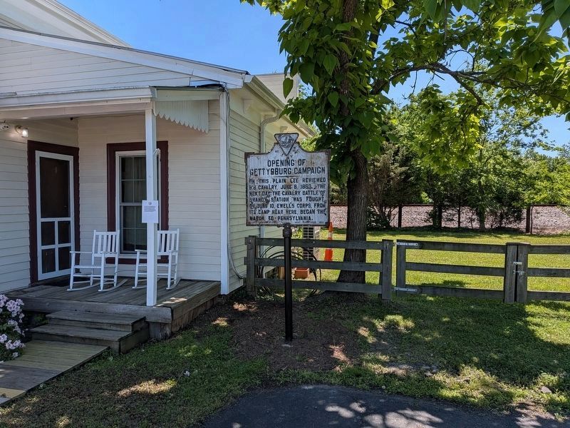
Photographed by Evan Dwyer, May 30, 2026
2. Opening of the Gettysburg Campaign Marker
The marker is enjoying retirement at the Graffiti House in Brandy Station.
Related marker. Click here for another marker that is related to this marker. Replacement Marker at this marker's original location also titled "Opening of the Gettysburg Campaign".
Also see . . .
1. Battle of Brandy Station. National Park Service website entry (Submitted on December 30, 2007, by Craig Swain of Leesburg, Virginia.)
2. Battle of Brandy Station Virtual Tour by Markers. A set markers that document the Battle of Brandy Station, June 9, 1863, and the Winter Encampment of 1863-64. Note the order of appearance is geographic and not chronologically aligned to the battle. (Submitted on January 1, 2008, by Craig Swain of Leesburg, Virginia.)

Photographed by Craig Swain, December 22, 2007
3. Opening of the Gettysburg Campaign Marker
This is a photo of the marker before it was removed and put into storage at Graffiti House.
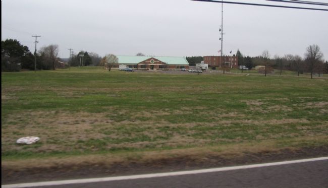
Photographed by Craig Swain, December 22, 2007
4. Site of the Cavalry Review
The State Police Headquarters stands in the center of what was the reviewing field. Confederate cavalry paraded past General Lee and staged mock battles during the review.
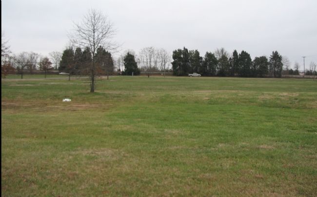
Photographed by Craig Swain, December 22, 2007
5. Review Field from the State Police Parking Lot
In the background, parallel to Brandy Road is the Orange and Alexandria Railroad. The proximity of this railroad to the field is no coincidence. The Confederate army was drawing upon this supply route in preparation for the march north.
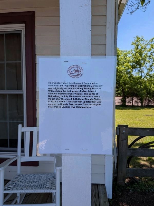
Photographed by Evan Dwyer, May 30, 2026
6. Temporary sign accompanying the marker at its current location.
Credits. This page was last revised on August 2, 2026. It was originally submitted on December 30, 2007, by Craig Swain of Leesburg, Virginia. This page has been viewed 2,431 times since then and 70 times this year. Last updated on June 4, 2026, by Evan Dwyer of Richmond, Virginia. Photos: 1. submitted on December 30, 2007, by Craig Swain of Leesburg, Virginia. 2. submitted on June 4, 2026, by Evan Dwyer of Richmond, Virginia. 3, 4, 5. submitted on December 30, 2007, by Craig Swain of Leesburg, Virginia. 6. submitted on June 4, 2026, by Evan Dwyer of Richmond, Virginia. • Devry Becker Jones was the editor who published this page.
