Riverdale in Fulton County, Georgia — The American South (South Atlantic)
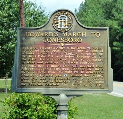
Howard's March to Jonesboro
Photographed by David Seibert, July 9, 2011
1. Howard's March to Jonesboro Marker
Ransom’s 16th & Blair’s 17th A.C. marched from Fairburn; Logan’s 15th, from Shadnor Ch., the 3 merging along this, the main rd. to Jonesboro.
Armstrong’s & Ross’ cav. [CS], resisted the advance from this side of Bethsaida Ch. to & beyond Camp Cr. as far as Renfroe's, from which place the Federals reached Flint River at 10 P.M.
Erected 1958 by Georgia Historical Commission. (Marker Number 060-170.)
Topics and series. This historical marker is listed in this topic list: War, US Civil. In addition, it is included in the Georgia Historical Society series list. A significant historical year for this entry is 1864.
Location. 33° 33.638′ N, 84° 27.647′ W. Marker is in Riverdale, Georgia, in Fulton County. It is on Bethsaida Road 0.1 miles west of Bethsaida Drive, on the left when traveling west. The marker is just (1/10 mile) east of the Fulton-Clayton
this page online

Regionally, this marker is in the Piedmont and in Metro Atlanta. It is also in the American South and specifically in the Deep South. Globally, it is in North America, the Western Hemisphere, the Western World, and the Anglosphere. Historically, it finds itself in what was once the territory of the Mississippian Culture, one of the original Thirteen Colonies, one of the Confederate States of America, and the Antebellum South.
Other nearby markers. At least 8 other markers are within 4 miles of this marker, measured as the crow flies: Bethsaida Baptist Church and Cemetery (about 500 feet away, measured in a direct line); 14th A.C. at Shoal Creek Church (approx. 2.2 miles away); Site: Shoal Cr. Church (approx. 2.2 miles away); Renfroe's Plantation (approx. 2.7 miles away); Memorial Georgia Gold Star Fathers (approx. 2.8 miles away); Riverdale Veterans Memorial (approx. 2.8 miles away); Site of Couch House (approx. 2.9 miles away); Baird’s Div., 14th A.C. (approx. 3.4 miles away). Touch for a list and map
Photographed by David Seibert, July 9, 2011
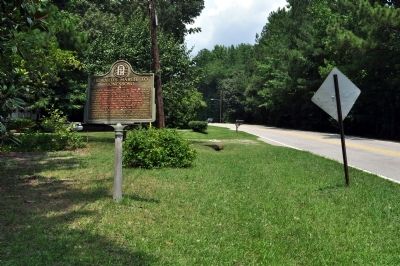
2. Howard's March to Jonesboro Marker
Looking west on Bethsaida Road, toward Fairburn and Shadnor Church
Photographed by David Seibert, July 9, 2011
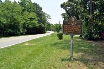
3. Howard's March to Jonesboro Marker
Lookng east on Bethsaida Road toward Bethsaida Church
Credits. This page was last revised on June 16, 2016. It was originally submitted on July 10, 2011, by David Seibert of Sandy Springs, Georgia. This page has been viewed 923 times since then and 39 times this year. Photos: 1, 2, 3. submitted on July 10, 2011, by David Seibert of Sandy Springs, Georgia. • Craig Swain was the editor who published this page.
