Near Culpeper in Culpeper County, Virginia — The American South (Mid-Atlantic)
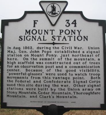
Mount Pony Signal Station
Erected 2000 by Department of Historic Resources. (Marker Number F-34.)
Topics and series. This historical marker is listed in these topic lists: Communications • War, US Civil. In addition, it is included in the Virginia Department of Historic Resources (DHR) series list. A significant historical month for this entry is August 1862.
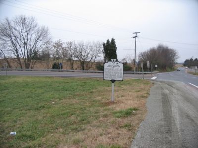
Location. 38° 26.665′ N, 78° 0.617′ W. Marker is near Culpeper, Virginia, in Culpeper County. Marker is at the intersection of James Madison Highway (U.S. 15) and Lovers Lane, on the right when traveling north on James Madison Highway. Touch for map. Marker is in this post office area: Culpeper VA 22701, United States of America. Touch for directions.
Other nearby markers. At least 8 other markers are within 2 miles of this marker, measured as the crow flies . Lee and Pope (approx. 0.6 miles away); Battle of Cedar Mountain (approx. 0.6 miles away); Greenwood (approx. 0.9 miles away); Col. John Jameson (approx. 1.6 miles away); Guinn Bungalow (approx. 1.7 miles away); 902 South East Street (approx. 1.8 miles away); 901 South East Street (approx. 1.8 miles away); Rixey-Yancey House (approx. 1.8 miles away). Touch for a list and map of all markers in Culpeper.
More about this marker. This marker replaced an older marker numbered F-15 with the title "Signal Station" which read "The lone peak to the northeast, Mount Pony, was used by Pope as a signal station, 1862." The same number was duplicated for another marker titled "Stonewall Jackson's Mother" located in Loudoun County also along James Madison Highway (U.S. Highway 15).
Regarding Mount Pony Signal Station. This is one of several markers interpreting the Battle of Cedar Mountain. See the Battle of Cedar Mountain Virtual Tour by Markers linked below.
Also see . . .
1. What was a Cold War Bunker on Mount Pony..... During the Cold War, Mount Pony was one of the Continuity of Government sites. In bunkers built into the mountain, up to a billion in U.S. currency was held as a reserve to revitalize the U.S. economy in the event of a nuclear attack. (Submitted on December 30, 2007, by Craig Swain of Leesburg, Virginia.)
2. .... Is now the National Audio-Visual Archives. After the end of the Cold War made such precautions unnecessary, the bunker complex was converted to store movies and sound recordings. (Submitted on December 30, 2007, by Craig Swain of Leesburg, Virginia.)
3. Library of Congress Packard Campus for Audio-Visual Conservation. State of the art archival facility where once a wooden signal tower stood. (Submitted on December 30, 2007, by Craig Swain of Leesburg, Virginia.)
4. Battle of Cedar Mountain Virtual Tour by Markers. A set markers that document the Battle of Cedar Mountain, August 9, 1862, and the early phases of the Second Manassas Campaign. (Submitted on January 1, 2008, by Craig Swain of Leesburg, Virginia.)

Photographed By Craig Swain, December 22, 2007
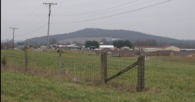
3. Mount Pony
Seen from the marker location, Mount Pony is one of several high points along the Rapidan River, which include Cedar, Clark's and Buzzard Mountains. The old bunker complex, now the Audio-Visual Archive facility, can be seen in the open ground below the crest of the mountain.
Credits. This page was last revised on July 6, 2021. It was originally submitted on December 30, 2007, by Craig Swain of Leesburg, Virginia. This page has been viewed 2,478 times since then and 76 times this year. Photos: 1, 2, 3. submitted on December 30, 2007, by Craig Swain of Leesburg, Virginia.

