Marker Logo HMdb.org THE HISTORICAL
MARKER DATABASE
“Bite-Size Bits of Local, National, and Global History”
Beaver Dam in Box Elder County, Utah — The American Mountains (Southwest)
 

Hansen Cooperative Dairy


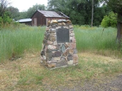
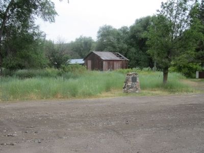
Hansen Cooperative Dairy Marker image. Click for full size.
Photographed By Vincent Cascio, July 7, 2011
1. Hansen Cooperative Dairy Marker
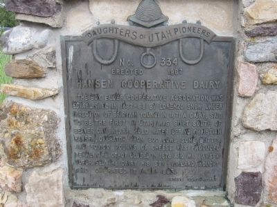
Inscription. The Box Elder Cooperative Association was established in 1867 -68 by Lorenzo Snow, under direction of Brigham Young. In 1871 a dairy, said to be the first in Utah, was built south of Beaver Dam, near a cold water spring, Christian Hansen, operator. From 600 cows, some butter and 50,000 pounds of cheese was produced yearly. The co-op closed in 1878 and Mr. Hansen purchased the dairy his son, Willard, bought and operated it until 1893.
 
Erected 1967 by Stage Coach Camp Daughters of Utah Pioneers. (Marker Number 334.)
 
Topics and series. This historical marker is listed in these topic lists: AgricultureSettlements & Settlers. In addition, it is included in the Daughters of Utah Pioneers series list. A significant historical year for this entry is 1867.
 
Location. 41° 47.667′ N, 112° 2.333′ W. Marker is in Beaver Dam, Utah, in Box Elder County. Marker is on West Beaver Dam Road, on the left when traveling west. Touch for map. Marker is at or near this postal address: 260 West Beaver Dam Road, Collinston UT 84306, United States of America. Touch for directions.
 
Other nearby markers. At least 8 other markers are within 12 miles of this marker, measured as the crow flies. Hampton's Bear River Crossing (approx. 3˝ miles away); Hensley/Salt Lake Cutoff - Hampton Ford (approx. 3˝ miles away); Restoration of the James G. Willie Home
Paid Advertisement
Click on the ad for more information.
Please report objectionable advertising to the Editor.
Click or scan to see
this page online
(approx. 6.6 miles away); Julia Budge Nibley House (approx. 11 miles away); David Eccles Home (approx. 11.1 miles away); First Hospital (approx. 11.1 miles away); 220 West Center (approx. 11.1 miles away); Cache County Court House (approx. 11.3 miles away).
 
Hansen Cooperative Dairy Marker image. Click for full size.
Photographed By Vincent Cascio, July 7, 2011
2. Hansen Cooperative Dairy Marker
Hansen Cooperative Dairy Marker image. Click for full size.
Photographed By Vincent Cascio, July 7, 2011
3. Hansen Cooperative Dairy Marker
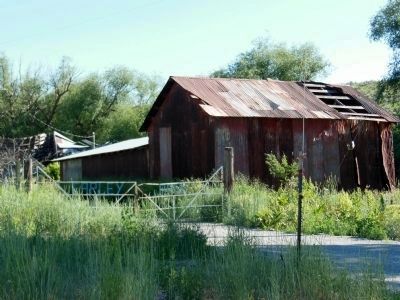
Abandoned Barn West of Marker image. Click for full size.
Photographed By Cosmos Mariner, June 17, 2013
4. Abandoned Barn West of Marker
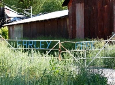
Close view of abandoned barn just west of the marker. Notice the dilapidated white wrought iron gate labeled "Earley Park".
"Earley Park" Gate image. Click for full size.
Photographed By Cosmos Mariner, June 17, 2013
5. "Earley Park" Gate
 
 
Credits. This page was last revised on August 28, 2020. It was originally submitted on July 10, 2011, by Vincent Cascio of Logan, Utah. This page has been viewed 887 times since then and 19 times this year. Photos:   1, 2, 3. submitted on July 10, 2011, by Vincent Cascio of Logan, Utah.   4, 5. submitted on April 10, 2014, by Cosmos Mariner of Cape Canaveral, Florida. • Bill Pfingsten was the editor who published this page.
Share this page.  
Share on Tumblr
m=44467

CeraNet Cloud Computing sponsors the Historical Marker Database.
This website earns income from purchases you make after using our links to Amazon.com. We appreciate your support.
Paid Advertisement
Apr. 18, 2024