Tree Park in Chattanooga in Hamilton County, Tennessee — The American South (East South Central)
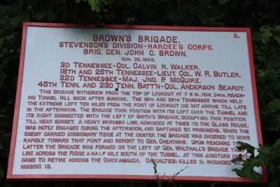
Brown's Brigade.
Stevenson's Division - Hardee's Corps.
— Brig. Gen. John C. Brown. —
Stevenson's Division - Hardee's Corps.
Brig. Gen. John C. Brown.
Nov. 25, 1863
3d Tennessee - Col. Calvin H. Walker.
18th and 26th Tennessee - Lieut. Col. W. R. Butler.
32d Tennessee - Maj. Jno. P. McGuire.
45th Tenn. and 23d Tenn. Batt'n - Col. Anderson Searcy.
This Brigade withdrew from the top of Lookout at 7 p.m., Nov. 24th, reaching Tunnel Hill soon after sunrise. The 18th and 26th Tennessee which held the extreme left ten miles from the point of Lookout did not arrive till late in the afternoon. The Brigade took position with its left over the Tunnel and its right connected with the left of Smith's Brigade, occupying this position till near sunset. A heavy skirmish line, advanced at times to the Glass House, was hotly engaged during the afternoon, and captured 50 prisoners. When the enemy carried Missionary Ridge at the center the Brigade was ordered to move rapidly toward that point and report to Gen. Cheatham. Upon reaching the Latter the Brigade was formed on the left of Gen. Walthall's Brigade then a line across the Ridge a half mile south of the tunnel. At this juncture orders came to retire across the Chickamauga. Casualties: killed 2; wounded 35; missing 13.
Erected 1890 by the Chickamauga-Chattanooga National Battlefield Commission. (Marker Number MT-367.)
Topics and series. This historical marker is listed in this topic list: War, US Civil. In addition, it is included in the Chickamauga and Chattanooga National Military Park, Sherman Reservation, and the Chickamauga and Chattanooga National Military Park: November 25, 1863 series lists. A significant historical date for this entry is October 25, 1836.
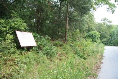
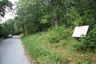
Location. 35° 3.991′ N, 85° 14.451′ W. Marker is in Chattanooga, Tennessee, in Hamilton County. It is in Tree Park. Marker is on North Crest Road north of Lightfoot Mill Road, on the right when traveling north. This historical marker is located just beyond the footpath entrance to the Sherman Reservation (at the intersection of North Crest and Lightfoot Mill roads) and just before the point where North Crest Road deadends at a blocked vehicle entrance to the Sherman Reservation. Touch for map. Marker is in this post office area: Chattanooga TN 37406, United States of America. Touch for directions.
Other nearby markers. At least 8 other markers are within walking distance of this marker. Barrett's C.S.A. Missouri Battery (within shouting distance of this marker); Barret's Missouri Battery (about 300 feet away, measured in a direct line); Hardee's Corps (about 300 feet away); Douglas' (Texas) Battery (about 300 feet away); Howell's Georgia Battery (about
400 feet away); Calvert's (Arkansas) Battery (about 500 feet away); Lewis' Brigade (about 800 feet away); 90th Illinois Infantry (about 800 feet away). Touch for a list and map of all markers in Chattanooga.
Credits. This page was last revised on February 7, 2023. It was originally submitted on July 12, 2011, by Dale K. Benington of Toledo, Ohio. This page has been viewed 585 times since then and 10 times this year. Photos: 1, 2, 3. submitted on July 12, 2011, by Dale K. Benington of Toledo, Ohio.


