Tomah in Monroe County, Wisconsin — The American Midwest (Great Lakes)
Robert Howie
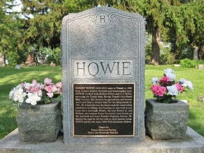
Photographed by Keith L, June 18, 2011
1. Robert Howie Marker
Tomah Historical Society,
Howie and Strozinsky Families
Erected by Tomah Historical Society and the Howie and Strozinsky Families.
Topics. This historical marker is listed in these topic lists: Immigration • Settlements & Settlers. A significant historical year for this entry is 1858.
Location. 43° 57.69′ N, 90° 30.481′ W. Marker is in Tomah, Wisconsin, in Monroe County. It can be reached from Superior Avenue (State
this page online

Regionally, this marker is in the American Midwest and in the Corn Belt. Globally, it is in North America, the Western Hemisphere, the Western World, and the Anglosphere. Historically, it finds itself in what was once the territory of the Mississippian Culture and also the Northwest Territory.
Other nearby markers. At least 8 other markers are within 10 miles of this marker, measured as the crow flies: Tomah (approx. 2.2 miles away); In Honor of All Who Have Served (approx. 8.7 miles away); Ice Age National Scientific Reserve (approx. 9½ miles away); Welcome to the Islands! (approx. 9.6 miles away); Glacial Lake Wisconsin (approx. 9.6 miles away); Long Bluff (approx. 9.6 miles away); Landmarks for Travelers (approx. 9.6 miles away); Mesas and Buttes (approx. 9.6 miles away).
Also see . . . Tomah, Wisconsin History. Tomah
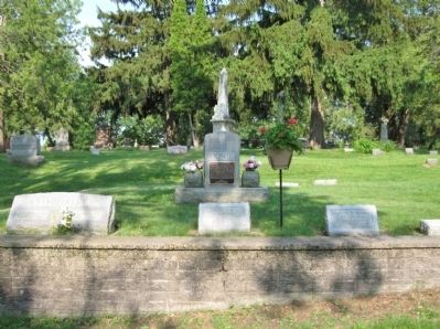
Photographed by Keith L, June 18, 2011
2. Robert Howie Marker
Credits. This page was last revised on December 8, 2024. It was originally submitted on July 19, 2011, by Keith L of Wisconsin Rapids, Wisconsin. This page has been viewed 1,112 times since then and 34 times this year. Photos: 1, 2. submitted on July 19, 2011, by Keith L of Wisconsin Rapids, Wisconsin.
