Wytheville in Wythe County, Virginia — The American South (Mid-Atlantic)
Walter Crockett
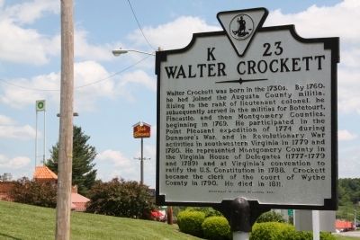
Photographed by J. J. Prats, May 28, 2011
1. Walter Crockett Marker
Walter Crockett was born in the 1730s. By 1760, he had joined the Augusta County militia. Rising to the rank of lieutenant colonel, he subsequently served in the militias of Botentourt, Fincastle, and then Montgomery Counties, beginning in 1769. He participated in the Point Pleasant expedition of 1774 during Dunmore’s War, and in Revolutionary War activities in southwestern Virginia in 1779 and 1780. He represented Montgomery County in the Virginia House of Delegates (1777–1779 and 1789) and at Virginia’s convention to ratify the U.S. Constitution in 1788. Crockett became the clerk of the court of Wythe County in 1790. He died in 1811.
Erected 2001 by Department of Historic Resources. (Marker Number K-23.)
Topics and series. This historical marker is listed in these topic lists: Colonial Era • War, US Revolutionary • Waterways & Vessels. In addition, it is included in the Virginia Department of Historic Resources (DHR) series list. A significant historical year for this entry is 1760.
Location. 36° 56.866′ N, 81° 3.551′ W. Marker is in Wytheville, Virginia, in Wythe County. It is at the intersection of East
this page online

Regionally, this marker is in Southwest Virginia and in the Blue Ridge Highlands. It is also in the American South, specifically in the Upper South, in Appalachia, and specifically in Southern Appalachia. Globally, it is in North America, the Western Hemisphere, the Western World, and the Anglosphere. Historically, it finds itself in what was once the territory of the Mississippian Culture, one of the original Thirteen Colonies, one of the Confederate States of America, and the Antebellum South.
Other nearby markers. At least 8 other markers are within 2 miles of this marker, measured as the crow flies: Robert Enoch Withers (approx. 0.6 miles away); Our Confederate Dead (approx. 1.1 miles away); Wytheville Training School (approx. 1.1 miles away); St. John's Episcopal Church (approx. 1.3 miles away); Edith Bolling Wilson (approx. 1.3 miles away);
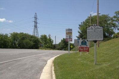
Photographed by J. J. Prats, May 28, 2011
2. Walter Crockett Marker
More about this marker. This marker replaced a 1930s marker with the same number titled “A Colonial Soldier’s Home” that read, “Five miles north was the home of Walter Crockett, a captain in the Point Pleasant Indian expedition of 1774 and the suppressor of a Tory rising in 1779. He was county lieutenant and clerk of Wythe County.”
Regarding Walter Crockett. He was born in present-day Tazewell County.
Also see . . . Col. Walter Crockett. Montgomery History Notes website entry (Submitted on October 1, 2024, by Larry Gertner of New York, New York.)
Credits. This page was last revised on October 1, 2024. It was originally submitted on July 23, 2011, by J. J. Prats of Powell, Ohio. This page has been viewed 2,602 times since then and 97 times this year. Photos: 1, 2. submitted on July 23, 2011, by J. J. Prats of Powell, Ohio.
