Near Warsaw in Kosciusko County, Indiana — The American Midwest (Great Lakes)
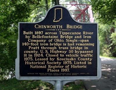
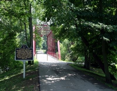
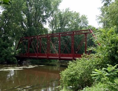
Chinworth Bridge
Built 1897 across Tippecanoe River by Bellefontaine Bridge and Iron Company of Ohio. Single-span 140-foot iron bridge is last remaining Pratt through truss bridge in county. U.S. Highway 30 bypassed it in 1924. Closed to vehicle traffic 1975. Leased by Kosciusko County Historical Society 1975. Listed in National Register of Historic Places 1997.
Erected 1999 by Indiana Historical Bureau, Kosciusko County Historical Society, and Kosciusko County Convention and Visitors Bureau. (Marker Number 43.2007.1.)
Topics and series. This historical marker is listed in these topic lists: Bridges & Viaducts • Industry & Commerce • Roads & Vehicles. In addition, it is included in the Indiana Historical Bureau Markers series list. A significant historical year for this entry is 1897.
Location. 41° 14.85′ N, 85° 54.65′ W. Marker is near Warsaw, Indiana, in Kosciusko County. Marker can be reached from the intersection of Old U.S. 30 and Road 350 N, on the left when traveling west. Marker is located within the Chinworth Bridge Trailhead Park. Park in parking lot and walk to the marker. Touch for map. Marker is in this post office area: Warsaw IN 46580, United States of America. Touch for directions.
Other nearby markers. At least 8 other markers are within 3 miles of this marker, measured as the crow flies. Indiana ... Where It All Began! (a few steps from this marker); Chinworth Bridge Trailhead (a few steps from this marker); The Lincoln Highway (a few steps from this marker); Highland Cemetery (approx. 2.2 miles away); Tony Elliott (approx. 2.6 miles away); a different marker also named The Lincoln Highway (approx. 2.6 miles away); M3A3 Stuart Tank (approx. 2.8 miles away); Kosciusko County War Memorial (approx. 2.8 miles away). Touch for a list and map of all markers in Warsaw.
More about this marker. There is also a gazebo located in the park with information about the history of the Lincoln Highway.
Also see . . . The Chinworth Bridge. Kosciusko County Historical Society website entry (Submitted on July 23, 2011, by Dave Zollinger of Goshen, Indiana.)
Credits. This page was last revised on September 26, 2021. It was originally submitted on July 23, 2011, by Dave Zollinger of Goshen, Indiana. This page has been viewed 741 times since then and 13 times this year. Photos: 1, 2, 3. submitted on July 23, 2011, by Dave Zollinger of Goshen, Indiana. • Bill Pfingsten was the editor who published this page.


