Near Elk Park in Avery County, North Carolina — The American South (South Atlantic)
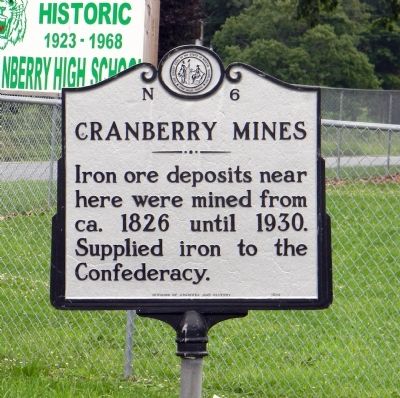
Cranberry Mines
Erected 1939 by North Carolina Division of Archives and History. (Marker Number N-6.)
Topics and series. This historical marker is listed in these topic lists: Industry & Commerce • War, US Civil. In addition, it is included in the North Carolina Division of Archives and History series list. A significant historical year for this entry is 1826.
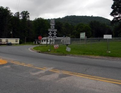
Location. 36° 9.12′ N, 81° 57.819′ W. Marker is near Elk Park, North Carolina, in Avery County. Marker is at the intersection of U.S. 19E and Elk Park Highway (North Carolina Highway 194) on U.S. 19E. Touch for map. Marker is in this post office area: Elk Park NC 28622, United States of America. Touch for directions.
Other nearby markers. At least 8 other markers are within 6 miles of this marker, measured as the crow flies. Cranberry Iron Mine (within shouting distance of this marker); Avery County Salute to Veterans (approx. 4.9 miles away); Avery County Veterans Monument (approx. 4.9 miles away); Former Avery County Jail (approx. 5 miles away); Lees-McRae College (approx. 5 miles away); Shepherd M. Dugger (approx. 5 miles away); Banner Elk (approx. 5.2 miles away); Overmountain Men (approx. 5.4 miles away).
Also see . . . Mining Artifacts & History: North Carolina Mines. (Submitted on July 24, 2011, by PaulwC3 of Northern, Virginia.)
Credits. This page was last revised on January 28, 2021. It was originally submitted on July 24, 2011, by PaulwC3 of Northern, Virginia. This page has been viewed 1,082 times since then and 25 times this year. Photos: 1, 2. submitted on July 24, 2011, by PaulwC3 of Northern, Virginia.
Editor’s want-list for this marker. Photos of modern day views of the Cranberry Mines • Can you help?

