Near Council Grove in Morris County, Kansas — The American Midwest (Upper Plains)
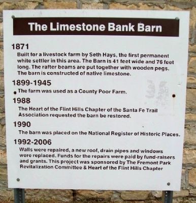
The Limestone Bank Barn
1871
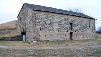
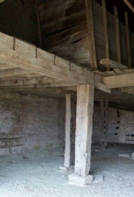
Built for a livestock farm by Seth Hays, the first permanent white settler in this area. The Barn is 41 feet wide and 76 feet long. The rafter beams are put together with wooden pegs. The barn is constructed of native limestone.
1899-1945
The farm was used as a County Poor Farm.
1988
The Heart of the Flint Hills Chapter of the Santa Fe Trail Association requested the barn be restored.
1990
The barn was placed on the National Register of Historic Places.
1992-2006
Walls were repaired, a new roof, drain pipes and windows were replaced. Funds for the repairs were paid by fund-raisers and grants. This project was sponsored by The Fremont Park Revitalization Committee & Heart of the Flint Hills Chapter
Erected by The Fremont Park Revitalization Committee and The Heart of the Flint Hills Chapter, SFTA.
Topics. This historical marker is listed in these topic lists: Agriculture • Architecture • Settlements & Settlers. A significant historical year for this entry is 1871.
Location. 38° 40.204′ N, 96° 26.976′ W. Marker is near Council Grove, Kansas, in Morris County. Marker is at the Morris County Fairgrounds, off US Route 56 east of town. Touch for map . Marker is in this post office area: Council Grove KS 66846, United States of America. Touch for directions.
Other nearby markers. At least 8 other markers are within 2 miles of this marker, measured as the crow flies. Morris County 4-H Fairgrounds Circle of History (approx. 0.2 miles away); Sylvan Park Depot (approx. 1.8 miles away); Pioneer Cowboy Jail (approx. 1.8 miles away); Company "C" 137th Infantry (approx. 1.9 miles away); Council Grove (approx. 2 miles away); Council Oak (approx. 2 miles away); Santa Fe Trail / Council Grove (approx. 2 miles away); a different marker also named Council Oak (approx. 2 miles away). Touch for a list and map of all markers in Council Grove.
Also see . . .
1. Big John Farm Limestone Bank Barn National Register Nomination. Kansas Historical Society website entry (Submitted on July 26, 2011, by William Fischer, Jr. of Scranton, Pennsylvania.)
2. Seth Millington Hays. Kansapedia website entry (Submitted on January 25, 2022, by Larry Gertner of New York, New York.)
3. Our Rich History. Council Grove Area Trade & Tourism Association website entry (Submitted on July 25, 2011, by William Fischer, Jr. of Scranton, Pennsylvania.)
4. 8 Wonders of Kansas History: Council Grove, Santa Fe Trail National Historic Landmark. Kansas Sampler Foundation website entry (Submitted on July 25, 2011, by William Fischer, Jr. of Scranton, Pennsylvania.)
Credits. This page was last revised on August 29, 2023. It was originally submitted on July 25, 2011, by William Fischer, Jr. of Scranton, Pennsylvania. This page has been viewed 461 times since then and 18 times this year. Photos: 1, 2, 3. submitted on July 25, 2011, by William Fischer, Jr. of Scranton, Pennsylvania.


