Ironwood in Gogebic County, Michigan — The American Midwest (Great Lakes)
Pabst Mine "H" Shaft
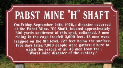
Photographed by Paul Fehrenbach, July 18, 2011
1. Pabst Mine "H" Shaft Marker
Topics. This historical marker is listed in this topic list: Notable Events. A significant historical date for this entry is September 24, 1844.
Location. 46° 27.366′ N, 90° 8.201′ W. Marker is in Ironwood, Michigan, in Gogebic County. It is on Bonnie Street ¼ mile south of E. Ayer St.,. Touch for map. Marker is in this post office area: Ironwood MI 49938, United States of America. Touch for directions.

Regionally, this marker is on the Upper Peninsula. It is also in the American Midwest and on Lake Superior’s South Shore Region. Globally, it is in North America, in the Great North Woods, on the Great Lakes, in the Western Hemisphere, in the Western World, and in the Anglosphere. Historically, it finds itself in what was once the Northwest
this page online
Other nearby markers. At least 8 other markers are within 2 miles of this marker, measured as the crow flies: The Truth Behind the Legend of Stormy Kromer (approx. 0.4 miles away); Newport Hill (approx. half a mile away); Curry House (approx. 1.1 miles away); Hiawatha (approx. 1.3 miles away); Commemorating the Iron Ore Industry (approx. 1.3 miles away); Miners Memorial Heritage Park (approx. 1.3 miles away); Ironwood City Hall (approx. 1.6 miles away); Italians on the Gogebic Iron Range (approx. 1.6 miles away). Touch for a list and map of all markers in Ironwood.
Additional keywords. Disasters, Mining
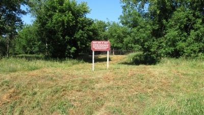
Photographed by Paul Fehrenbach, July 18, 2011
2. Pabst Mine "H" Shaft Marker
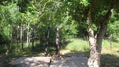
Photographed by Paul Fehrenbach, July 18, 2011
3. Pabst Mine "H" Shaft
This is the "H" shaft located behind the marker. "G" shaft is located 300 yards to the southwest.
Credits. This page was last revised on November 25, 2020. It was originally submitted on July 25, 2011, by Paul Fehrenbach of Richfield, Wisconsin. This page has been viewed 2,589 times since then and 175 times this year. Photos: 1, 2, 3. submitted on July 25, 2011, by Paul Fehrenbach of Richfield, Wisconsin. • Bill Pfingsten was the editor who published this page.
