Near Nevada City in Nevada County, California — The American West (Pacific Coastal)
Purdon Bridge
1895
Photographed by Barry Swackhamer, July 25, 2011
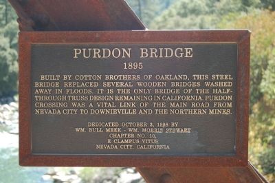
1. Purdon Bridge Marker
Erected 1998 by E Clampus Vitus, Wm. Bull Meek – Wm. Morris Stewart, Chapter No. 10.
Topics and series. This historical marker is listed in these topic lists: Bridges & Viaducts • Landmarks • Roads & Vehicles. In addition, it is included in the E Clampus Vitus series list.
Location. 39° 19.646′ N, 121° 2.804′ W. Marker is near Nevada City, California, in Nevada County. It is on Purdon Road, on the right when traveling north. The marker is located on the South Yuba River approximately 9 miles north of Highway 49. Touch for map. Marker is at or near this postal address: 20198 Purdon Road, Nevada City CA 95959, United States of America. Touch for directions.

Regionally, this marker is in the Sierra Nevada. It is also in the American Mountain West. Globally,
this page online
Other nearby markers. At least 8 other markers are within 5 miles of this marker, measured as the crow flies: Henness Pass Road - Oak Tree Ranch (approx. 2.1 miles away); Sheriff David Fulton Douglass (approx. 3.6 miles away); Pioneer Emigrant Trail (approx. 3.8 miles away); North San Juan Fire Department (approx. 4.2 miles away); Hydraulic Mining (approx. 4.2 miles away); Wells Fargo & Company / North San Juan (approx. 4.3 miles away); Old North San Juan School (approx. 4.3 miles away); American Hill Diggings (approx. 4.3 miles away). Touch for a list and map of all markers in Nevada City.
Photographed by Barry Swackhamer, July 25, 2011
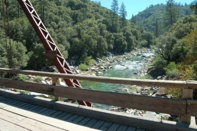
2. Purdon Bridge Marker
The bridge crosses over the South Yuba River.
Photographed by Barry Swackhamer, July 25, 2011
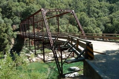
3. The Purdon Bridge
Photographed by Barry Swackhamer, July 25, 2011
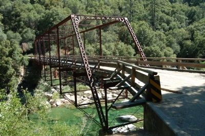
4. The Purdon Bridge
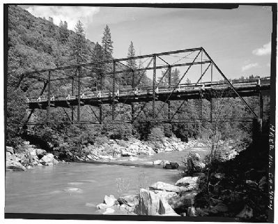
Library of Congress Prints and Photographs Division
5. Purdon Crossing Bridge
HAER CAL,29-NEVCI.V,1-
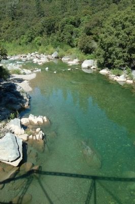
Photographed by Barry Swackhamer, July 25, 2011
6. The South Yuba River.
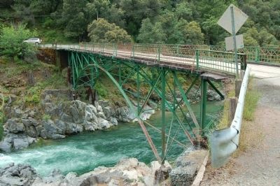
Photographed by Barry Swackhamer, June 3, 2011
7. Edwards Crossing Bridge
The Edwards Crossing Bridge is located to the east of the Purdon Bridge on the North Bloomfield Road. It was registered as Nevada County Historical Landmark 95-03 on September 19, 1995. "Description: Edwards Crossing Bridge
"Built in 1904 by the the American Bridge Company of steel-connected-pin design to replace a wooden structure built in 1862 by Willian Edwards. In 1854, Edwards began operations here with a ferry, and in 1855 he built a bridge and tool road between Blue Tent and Lake City. His first bridge washed away in December 1861, and was replaced the following year. The county acquired the bridge sometime after 1880."
Exploring Nevada County by Nevada County Historical Landmarks Commission.
Credits. This page was last revised on June 16, 2016. It was originally submitted on July 26, 2011, by Barry Swackhamer of Brentwood, California. This page has been viewed 2,029 times since then and 133 times this year. Photos: 1, 2, 3, 4. submitted on July 26, 2011, by Barry Swackhamer of Brentwood, California. 5. submitted on July 26, 2011. 6, 7. submitted on July 26, 2011, by Barry Swackhamer of Brentwood, California. • Syd Whittle was the editor who published this page.
