Schurz in Mineral County, Nevada — The American Mountains (Southwest)
Walker River Reservation
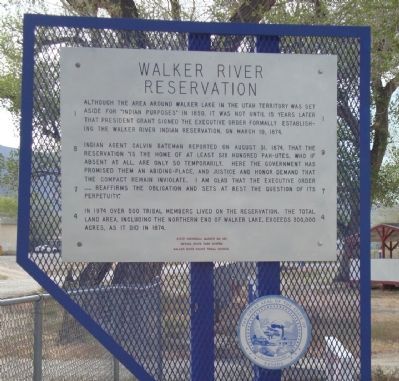
Although the area around Walker Lake in the Utah Territory was set aside for “Indian purposes” in 1859, it was not until 15 years later that President Grant signed the executive order formally establishing the Walker River Indian Reservation, on March 19, 1874.
Indian Agent Calvin Bateman reported on August 31, 1874, that the reservation “is the home of at least six hundred Pah-utes, who if absent at all, are only so temporarily. Here the government has promised them an abiding-place, and justice and honor demand that the compact remain inviolate. I am glad that the executive order ….. reaffirms the obligation and sets at rest the question of its perpetuity.”
In 1974 over 500 tribal members lived on the reservation. The total land area, including the northern end of Walker Lake, exceeds 300,000 acres, as it did in 1874.
Erected by Nevada State Park System, Walker River Paiute Tribal Council. (Marker Number 183.)
Topics and series. This historical marker is listed in these topic lists: Native Americans • Settlements & Settlers. In addition, it is included in the Former U.S. Presidents: #18 Ulysses S. Grant series list. A significant historical month for this entry is March 1995.
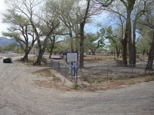
Location. 38° 57.142′ N, 118° 48.636′ W. Marker is in Schurz, Nevada, in Mineral County. Marker is at the intersection of U.S. 95 and Cottonwood Lane, on the left on U.S. 95. Touch for map. Marker is in this post office area: Schurz NV 89427, United States of America. Touch for directions.
Credits. This page was last revised on August 2, 2020. It was originally submitted on July 26, 2011. This page has been viewed 599 times since then and 31 times this year. Photos: 1, 2. submitted on July 26, 2011, by Mh of Las Vegas, Nevada. 3, 4. submitted on August 22, 2011. 5, 6. submitted on August 23, 2011. • Syd Whittle was the editor who published this page.
