
Seeking Buyers and Sellers
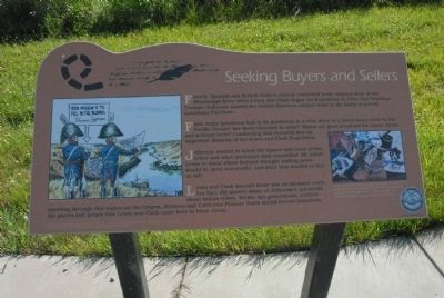
First, many questions had to be answered: Is it true there is a direct water route to the Pacific Ocean? Are there minerals to mine? Where are good locations for towns, farmers, and military forts? Conducting this research was an important mission of the Lewis and Clark Expedition.
Jefferson wanted to know the names and sizes of the tribes and what territories they controlled. He asked Lewis to learn where Indians thought trading posts would be most successful, and what they wanted to buy or sell.
Lewis and Clark learned there was no all-water route, but they did answer many of Jefferson’s questions about Indian tribes. Within two generations, settlers traveling through this region on the Oregon, Mormon and California Pioneer Trails would forever transform the places and people that Lewis and Clark came here to learn about.
Graphic: Lewis and Clark brought
this page online
Topics and series. This historical marker is listed in these topic lists: Exploration • Indigenous Peoples and Communities • Industry & Commerce. In addition, it is included in the Former U.S. Presidents: #03 Thomas Jefferson, and the Lewis & Clark Expedition series lists. A significant historical year for this entry is 1804.
Location. 41° 13.687′ N, 95° 53.991′ W. Marker is in Council Bluffs, Iowa, in Pottawattamie County. It is on 34th Ave/. Located near walkway leading from parking lot to the Western Historic Trails Center, Lied Historical Building. Touch for map. Marker is at or near this postal address: 3434 Richard Downing Ave, Council Bluffs IA 51501, United States of America. Touch for directions.

Regionally, this marker is in Western Iowa, in Loess Hills, and in Greater Omaha. It is also in the American Midwest, in the Lewis & Clark Corridor, and in the Corn Belt. Globally, it is in North America, the Western Hemisphere, the Western World, and the Anglosphere. Historically, it finds itself in what was once the territory of the Mississippian Culture and also the Louisiana Purchase.
Other nearby markers. At least 8 other markers are within walking distance of this marker: Western Historic Trails Center; Starting the Journey (here, next to this marker); We Were All Busily Engaged (here, next to this marker); A New World of Plants (approx. 0.9 miles away in Nebraska); History of Union Pacific and Omaha (approx. one mile away in Nebraska); Legends of Union Pacific (approx. one mile away in Nebraska); The Big Boy (approx. one mile away in Nebraska); Union Pacific Railroad (approx. one mile away in Nebraska); The Centennial (approx. one mile away in Nebraska). Touch for a list and map of all markers in Council Bluffs.
Credits. This page was last revised on December 6, 2024. It was originally submitted on July 28, 2011, by Charles T. Harrell of Woodford, Virginia. This page has been viewed 1,060 times since then and 25 times this year. Photo 1. submitted on July 28, 2011, by Charles T. Harrell of Woodford, Virginia. • Bill Pfingsten was the editor who published this page.
Editor’s want-list for this marker. A wide shot of the marker in context. • Can you help?
