Paradise in Sanders County, Montana — The American West (Mountains)
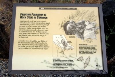
Phantom Formation Is Rock Solid In Corridor
Clark Fork Corridor: The Land
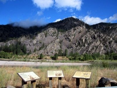
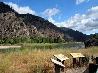
Across the river, the uplifting and shifting of the mountains has tilted the Prichard on its side. If you look closely at the large rocks at this turnoff, you may see ripple marks and mud cracks—evidence of their sedimentary origin.
Rock of Many Uses
Because the mudstone layers in the Prichard split apart to form flagstone, it has been quarried to provide colorful construction material for hearths, stone paths and facings for buildings. In addition, a slate-like rock found in the formation was used by early people to make tools and weapons.
Ancient Origins
The Prichard formed as layer upon layer of sand, silt and clay was deposited from a river delta into a sea covering parts of what is now Montana, Idaho, Washington and Canada. Over millions of years, heat and pressure turned the sediments into a hard, metamorphic rock, argillite.
Erected by Lolo National Forest.
Topics. This historical marker is listed in this topic list: Natural Features.
Location. 47° 19.053′ N, 114° 48.275′ W. Marker is in Paradise, Montana, in Sanders County. Marker is on State Highway 135, 3.3 miles south of State Highway 200, on the right when traveling south. Touch for map. Marker is in this post office area: Paradise MT 59856, United States of America. Touch for directions.
Other nearby markers. At least 8 other markers are within 11 miles of this marker, measured as the crow flies. Native People Sustained Through Many Millennia (a few steps from this marker); The Earth's Blood Flows Past You (a few steps from this marker); Coursing Through Miles Of Montana (approx. 1.9 miles away); Searching For Fur And A Finer Life (approx. 1.9 miles away); Wildlife Thrive In Corridor Year Round (approx. 1.9 miles away); Gideon Bibles (approx. 9.2 miles away); Superior School (approx. 9.4 miles away); Wild Horse Plains (approx. 10.2 miles away). Touch for a list and map of all markers in Paradise.
Also see . . . Lolo National Forest. (Submitted on July 29, 2011, by Bernard Fisher of Richmond, Virginia.)
Credits. This page was last revised on June 16, 2016. It was originally submitted on July 29, 2011, by Bernard Fisher of Richmond, Virginia. This page has been viewed 795 times since then and 14 times this year. Photos: 1, 2, 3. submitted on July 29, 2011, by Bernard Fisher of Richmond, Virginia.


