Arlington in Middlesex County, Massachusetts — The American Northeast (New England)
Whittemore Park
“Uncle Sam”
The birthplace of Samuel Wilson once stood near the main crossroad of the Northwest parish of Cambridge, the center of the district known as Menotomy. Wilson, born on September 13, 1766, was only eight when Paul Revere passed by the family homestead, riding to Lexington and Concord. On the next day, April 19, 1775, the battle between Redcoats retreating to Boston and Minutemen in pursuit raged around the boy’s home.
Wilson, moving to New Hampshire and eventually, as a grown man, to Troy, New York, became a meatpacker. His casks of beef and pork, destined for American troops in the War of 1812 and marked with the federal monogram “U.S.”, were recognized as his; and the legend grew that the letters stood for “Uncle Sam” Wilson. Wilson himself, a dapper, handsome gentleman, became the symbol of the young country. His first home, standing at the nation’s very birthplace, has long since disappeared; but Menotomy, now the Town of Arlington, honors “Uncle Sam” Wilson by a monumental statue standing near the site of his birth. The statue was sculpted by Theodore Barbarossa of Belmont and dedicated April 18, 1977, as a gift to the Town of Arlington and the people of the United States from Frederick A. Hauck of Cincinnati, Ohio.
The Arlington Historical Commission
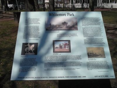
On April 19, 1775, Paul Revere rode over the Mystic River from Medford and on through this Menotomy intersection toward Lexington and Concord. This plaster cast of Paul Revere is taken from one of several portrait sculptures of him made by Cyrus E. Dallin, whose studio and home were in Arlington. Other Dallin works are exhibited in the Dallin Museum at the Jefferson Cutter House here in Whittemore Park.
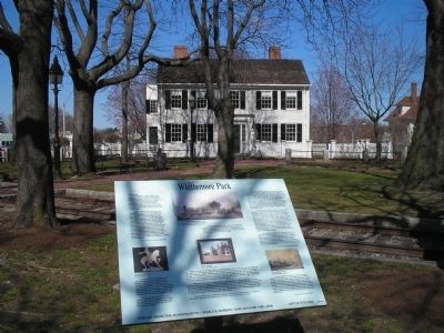
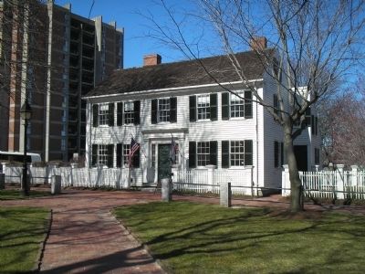
The House itself (built c. 1817 and formerly owned by mill owner Jefferson Cutter) was moved in 1989 from 1149 Massachusetts Avenue to this park as a gift to the Town from The John Mirak Family.
As it pushed through the New England landscape, the railroad changed forever the ways of life once so dependents on horses and oxen for daily transportation. Arlington, with its ice harvesting and market gardening industries, benefited particularly from the arrival of the “iron Horse” in 1846.
More than two centuries ago, a Boston silversmith jumped on his horse and took a late-night ride that would change the course of history. That midnight rider was, of course, Paul Revere. On his way to warn Massachusetts officials of British troop movements, Revere raced through colonial Arlington and Lexington. “The British are coming!” he cried out all the way, “the British are coming!” The next morning, on April 19th, 1775, Minutemen fired the first shot against British troops on Lexington Green. After years of colonial unrest, the American Revolution had indeed begun.
Today, an unused railroad corridor (much of which parallels Paul Revere’s famous route) has become the Minuteman Bikeway. The rail-trail conversion was made possible by the Clean Air Act of 1977 and funded by the Commonwealth of Massachusetts at a cost of $2 million. In 1992, the Minuteman Bikeway was named America’s 500th Rail-Trail by the Rails-to-Trails Conservancy. In September 2000, the part of the Minuteman Bikeway in Arlington was renamed The Donald R. Marquis Bikeway to honor his service as Arlington’s Town Manger from 1966 to 2000.
About 15 miles long, the Minuteman Bikeway begins near the Alewife MBTA (“T”) Station in Cambridge, passes through Arlington and Lexington, and ends one mile into Bedford.
English Puritan Colonists first settled in Arlington in the 1630s. They were drawn to its fertile fields and swiftly running stream, Mill Brook. This stream had in fact given the area the name Menotomy, which means “swiftly running water” in the language of the Massachusetts tribe. The area continued to be known as Menotomy through the 17th and 18th centuries, even though at that time it was officially Northwest or Second parish of Cambridge. By the 19th century, the area was populous enough and so distinct from the rest of Cambridge that, in 1807, it became a separate town, West Cambridge. In order to distinguish itself further from its parent community and to honor its Civil War dead, the town changed its name to Arlington in 1867.
The area has had a history as varied as its name, with the small farms and simple mills of the colonists developing into major industries in the 19th century and then transforming in the 20th century into the residential suburb that it remains today. In the 19th century Arlington’s hothouses and market gardens, especially famous for their celery, supplied the entire East Coast; its Spy Pond ice industry sent its agents as far away as India. The nation’s first saw manufacturer located in Grove Street, and the inventor of a machine to make wool cards, which revolutionized the textile industry, established its first factory on Massachusetts Avenue. Sawmills, gristmills, paint, spice, drug, and woodworking mills, shoe factories, calico stamping works, and ice tool manufacturers were all major industries in Arlington; and some of their histories may be read today at sites along the bikeway.
Traveling around the town, one will see, too, the many handsome residences dating from the 18th century to the present, the homes not only of Arlington’s farmers, craftsmen, and industrialists but also of noted professional people and artists. Finally, prominent through the tour and more fully described at other Minuteman Bikeway locations are the sites made famous by the first great battle of the American Revolution, which took place within this town’s boundaries on April 19, 1775.
The Arlington Historical Commission
The characteristic generosity of the Arlington people is nowhere more evident than in the beautiful public buildings and park of the Town Center National Register Historic District, all gifts to the town from the Robbins Family, whose wealth was derived originally from the farms on which the Town was founded. The Italian Renaissance palace style Robbins Library and Town hall, the Federal-Style Whittemore-Robbins mansion and the Olmsted Brothers-designed gardens were given to the Town by Robbins family members over a forty-year period from 1892 to 1951.
The Arlington Historical Society
Erected 2000 by Town of Arlington.
Topics. This historical marker is listed in these topic lists: Colonial Era • Settlements & Settlers • War, US Revolutionary. A significant historical month for this entry is April 1727.
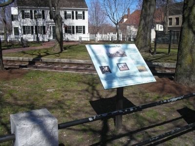
Location. 42° 24.926′ N, 71° 9.16′ W. Marker is in Arlington, Massachusetts, in Middlesex County. Marker is at the intersection of Massachusetts Avenue (U.S. 3) and Mystic Street (Massachusetts Route 60), on the right when traveling west on Massachusetts Avenue. Marker is located in Whittemore Park. Touch for map. Marker is at or near this postal address: 611 Massachusetts Avenue, Arlington MA 02474, United States of America. Touch for directions.
Other nearby markers. At least 8 other markers are within 2 miles of this marker, measured as the crow flies. Samuel Whittemore (a few steps from this marker); Old Men of Menotomy (about 300 feet away, measured in a direct line); Cooper’s Tavern (about 500 feet away); Captain Cooke’s Mill Lane (about 600 feet away); House of John Cutter (approx. ¼ mile away); Jason Russell House (approx. 0.3 miles away); James A. Logan (approx. 1.2 miles away); Arlington Reservoir (approx. 1.4 miles away). Touch for a list and map of all markers in Arlington.
More about this marker. Several pictures appear on the marker. One on the left depicts a statue of Paul Revere, sculpted by Cyrus E. Dallin (1864-1944). At the center of the marker is a picture by Edward Lamson Henry (1841-1919) of the railroad in Arlington (Courtesy of the Metropolitan Museum of Art). Below this is a c. 1835 painting of buildings in West Cambridge by an unknown artist. The lower right of the marker contains a picture of West Cambridge in 1817 (now Arlington Center).
Credits. This page was last revised on June 21, 2017. It was originally submitted on July 30, 2011, by Bill Coughlin of Woodland Park, New Jersey. This page has been viewed 1,283 times since then and 44 times this year. Photos: 1, 2, 3, 4. submitted on July 30, 2011, by Bill Coughlin of Woodland Park, New Jersey.


