
Schuylkill Township near Phoenixville in Chester County, Pennsylvania — The American Northeast (Mid-Atlantic)
Horse-Shoe Trail
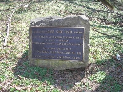
Photographed by Bill Coughlin, March 20, 2010
1. Horse-Shoe Trail Marker
Valley Forge to Appalachian Trail on Stony Mt.
121 miles – through
Chester, Berks, Lancaster, Lebanon, Dauphin counties.
This marker erected 1972
by the Horse-Shoe Trail Club, Inc. 1935
in memory of Henry N. Woolman, founder.
Erected 1935 by Horse-Shoe Trail Club, Inc.
Topics. This historical marker is listed in this topic list: Roads & Vehicles. A significant historical year for this entry is 1972.
Location. 40° 5.953′ N, 75° 27.845′ W. Marker is near Phoenixville, Pennsylvania, in Chester County. It is in Schuylkill Township. It can be reached from Valley Forge Road (Pennsylvania Route 23) west of Valley Creek Road ( Route 252), on the left when traveling west. Marker is located along the horse trail. Touch for map. Marker is at or near this postal address: 1299 Owen Dr, Phoenixville PA 19460, United States of America. Touch for directions.

Regionally, this marker is in Southeast Pennsylvania and in Greater Philadelphia. It is also in the American Northeast and in the Mid-Atlantic. Globally, it is in North America, the Western Hemisphere, the Western World, and the
this page online
Other nearby markers. At least 8 other markers are within walking distance of this marker: To Honor the Maker of First American Flag (about 300 feet away, measured in a direct line); Honor Court to Brigadier General Lachlan McIntosh (about 300 feet away); George Washington’s Coffee Bean Tree (about 300 feet away); Village of Valley Forge (about 400 feet away); Valley Creek (approx. 0.2 miles away); To Marylanders Who Served Here (approx. 0.2 miles away); Washington’s Headquarters (approx. ¼ mile away); American Icon (approx. ¼ mile away). Touch for a list and map of all markers in Phoenixville.
Another marker is no longer nearby. The Village of Valley Forge (was approx. ¼ mile away but has been permanently removed).
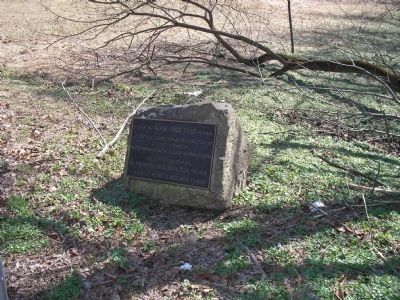
Photographed by Bill Coughlin, March 20, 2010
2. Horse-Shoe Trail Marker
Credits. This page was last revised on February 7, 2023. It was originally submitted on July 30, 2011, by Bill Coughlin of Woodland Park, New Jersey. This page has been viewed 832 times since then and 10 times this year. Photos: 1, 2. submitted on July 30, 2011, by Bill Coughlin of Woodland Park, New Jersey.
