Mammoth in Yellowstone National Park in Park County, Wyoming — The American West (Mountains)
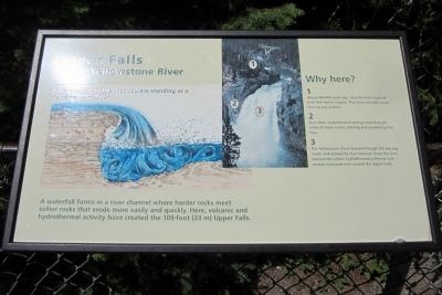
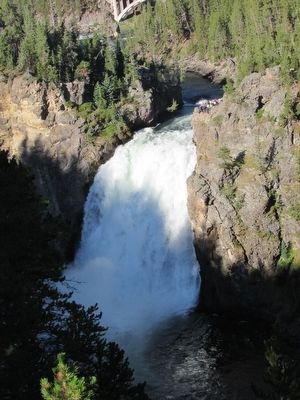
Upper Falls of the Yellowstone River
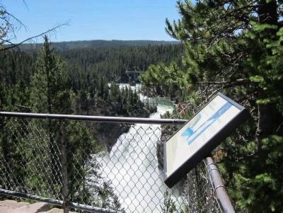
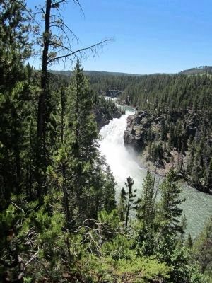
A waterfall forms in a river channel where harder rocks meet softer rocks that erode more easily and quickly. Here, volcanic and hydrothermal activity have created the 109-foot (33 m) Upper falls.
Why here?
1 About 480,000 years ago, lava formed a layer of rock that resists erosion. The lava naturally cracks in a zig-zag pattern.
2 Over time, hydrothermal springs rose through some of these cracks, altering and weakening the lava.
3 The Yellowstone River flowed through the zig-zag cracks and eroded its river channel. Once the river reached the softer, hydrothermally-altered rock, erosion increased and created the Upper Falls.
Topics. This historical marker is listed in this topic list: Natural Features.
Location. 44° 42.847′ N, 110° 29.88′ W. Marker is in Yellowstone National Park, Wyoming, in Park County. It is in Mammoth. Marker can be reached from South Rim Drive, 0.6 miles east of Grand Loop Road. Touch for map. Marker is in this post office area: Yellowstone National Park WY 82190, United States of America. Touch for directions.
Other nearby markers. At least 8 other markers are within walking distance of this marker. Uncle Tom’s Point (about 600 feet away, measured in a direct line); Brink of Upper Falls (about 700 feet away); Geologic Junction (approx. 0.2 miles away); Uncle Tom’s Trail (approx. 0.2 miles away); Brink of Lower Falls (approx. 0.4 miles away); Still Venting After All These Years (approx. 0.4 miles away); Chittenden Memorial Bridge (approx. half a mile away); Waterfall Makers (approx. 0.7 miles away). Touch for a list and map of all markers in Yellowstone National Park.
Also see . . . Yellowstone National Park. National Park Service (Submitted on July 30, 2011.)
Credits. This page was last revised on February 16, 2023. It was originally submitted on July 30, 2011, by Bernard Fisher of Richmond, Virginia. This page has been viewed 717 times since then and 38 times this year. Photos: 1, 2. submitted on July 30, 2011, by Bernard Fisher of Richmond, Virginia. 3. submitted on September 9, 2015, by Bill Coughlin of Woodland Park, New Jersey. 4. submitted on July 30, 2011, by Bernard Fisher of Richmond, Virginia. 5. submitted on September 9, 2015, by Bill Coughlin of Woodland Park, New Jersey.
