Yellowstone National Park in Teton County, Wyoming — The American West (Mountains)
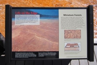
Life on the Edge
Photographed by Bernard Fisher, July 25, 2011
1. Life on the Edge Marker
Miniature Forests
Within the rainbow of orange, brown, and red colors, some microorganisms live in communities of thick mats. Like miniature forests, these mats have a vertical structure and stratified functions. Microbes that live on or near the top of the mat (similar to a forest canopy) use sunlight to perform photosynthesis, which fuels the mat community. Organisms living deeper in the mat (similar to a forest understory) derive energy from chemicals produced by the surface microbes. They perform other vital functions such as decomposition and recycling nutrients to the mat’s “canopy” just like their counterparts in a forest. All of these organisms create an ecosystem in the expanse of a few inches.
(sidebar)
Yellowstone National Park is one of the most accessible places to study extreme environments
this page online
Because conditions on other planets in our solar system are harsh, if life exists elsewhere it is probably as some form of microscopic extremophile.
This exhibit made possible by a generous grant to the Yellowstone Park Foundation from NASA Astrobiology Institute and Lockheed Martin Space Operations
Erected by Yellowstone Park Foundation.
Topics. This historical marker is listed in this topic list: Science & Medicine.
Location. 44° 31.545′ N, 110° 50.292′ W. Marker is in Yellowstone National Park, Wyoming, in Teton County. It can be reached from Grand Loop Road (U.S. 89) one mile south of Firehole Lake Drive, on the right when traveling south. Located in the Midway Geyser Basin. Touch for map. Marker is in this post office area: Moran WY 83013, United States of America. Touch for directions.

Regionally, this marker is in the Jackson Hole Area and in Greater Yellowstone. It is also in the American Mountain West. Globally, it
Photographed by Bernard Fisher, July 25, 2011
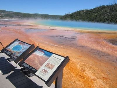
2. Midway Geyser Basin Markers
Other nearby markers. At least 8 other markers are within 3 miles of this marker, measured as the crow flies: Grand Prismatic Spring: Prism of Light, Spectrum of Life (here, next to this marker); Excelsior Geyser (about 300 feet away, measured in a direct line); Buried Alive (about 400 feet away); Grand Prismatic (approx. 0.2 miles away); White Dome Geyser (approx. 2 miles away); Fountain Paint Pot (approx. 2.3 miles away); a different marker also named Fountain Paint Pot (approx. 2.3 miles away); Earthquake’s Offspring (approx. 2.4 miles away). Touch for a list and map of all markers in Yellowstone National Park.
More about this marker. On the lower right are two illustrations with the captions:
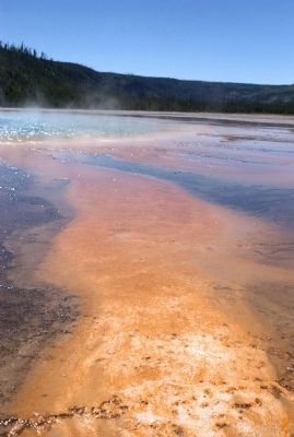
"Heat-loving photosynthetic microbes known as Phormidium and Synechococcus live in mats along Grand Prismatic Spring’s runoff channels."
"Cross section of a Phormidium and Synechococcus mat showing the photosynthetic microbes (orange and green) overlying the nonphotosynthetic microbes (black)."
Also see . . . Yellowstone National Park.
Photographed by Dan Fisher, July 24, 2011
3. Grand Prismatic Spring runoff
Credits. This page was last revised on November 14, 2021. It was originally submitted on July 31, 2011, by Bernard Fisher of Richmond, Virginia. This page has been viewed 948 times since then and 88 times this year. Photos: 1, 2, 3. submitted on July 31, 2011, by Bernard Fisher of Richmond, Virginia.
