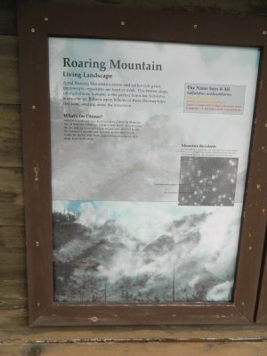
Roaring Mountain
Living Landscape
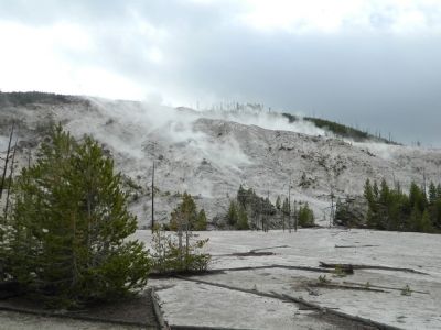
Amid Roaring Mountain's steam and sulfur-rich gases, microscopic organisms are hard at work. This barren slope, inhospitable to humans, is the perfect home for Sulfolobus acidocaldarius. Billions upon billions of these thermophiles live here, wearing away the mountain.
What's for Dinner?
Sulfolobus acidocaldarius, hardy residents of Roaring Mountain live on hydrogen sulfide gas escaping from below. They consume the gas, helping to convert it into sulfuric acid. The acid breaks the mountain;s volcanic rock into clay, accelerating erosion. Small, but mighty in number, Sulfolobus acidocaldarius, help shape Roaring Mountain.
Inset
The Name Says it All
Sulfolobus acidocaldarius,
Sulfo = Sulfur-eating
Lobus = Round or lobe-shaped
Acido = Adapted to living in an acidic place
Caldarius = A hot place, such as a cauldron
Photo
Mountain Residents
As seen through a microscope, tiny, dark Sulfolobus acidocaldarius, float in a sea of bright clay particles. These heat-loving microbes convert gases into acid, then the acid dissolves rock into clay.
Topics. This historical marker is listed in this topic list: Science & Medicine.
Location. 44° 46.867′ N, 110°
Other nearby markers. At least 8 other markers are within 5 miles of this marker, measured as the crow flies. Fumaroles (here, next to this marker); Obsidian Cliff (approx. 3 miles away); Norris Soldier Station (approx. 3.8 miles away); Living Thermometer (approx. 4.1 miles away); Norris Geyser Basin (approx. 4.1 miles away); a different marker also named Fumaroles (approx. 4.1 miles away); Porcelain Springs (approx. 4.1 miles away); Solfatara (approx. 4.2 miles away). Touch for a list and map of all markers in Yellowstone National Park.
Credits. This page was last revised on February 16, 2023. It was originally submitted on August 1, 2011, by Bill Pfingsten of Bel Air, Maryland. This page has been viewed 580 times since then and 16 times this year. Photos: 1, 2. submitted on August 1, 2011, by Bill Pfingsten of Bel Air, Maryland.

