Laurel in Sussex County, Delaware — The American Northeast (Mid-Atlantic)
Ted Harvey: Innovator for Preservation
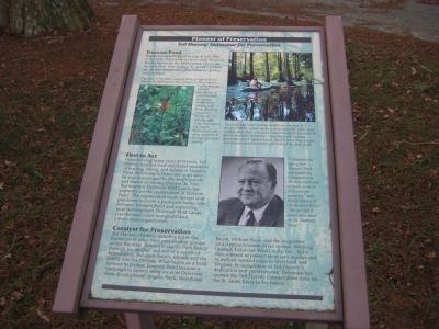
Pioneer of Preservation
Trussum Pond
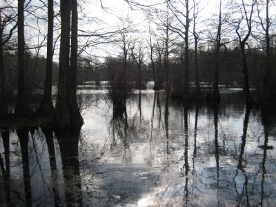
Tranquil waters trapped by a grist mill dam in the early nineteenth century made Trussum Pond a haven for the bald cypress. However, the trees now seen dotting the pond's surface are all that remain of a once extensive prehistoric wetland.
Deprived of the area's natural cycle of high and low waters, the bald cypress trees caught in the pond are visible only as strange hummocks of gnarled wood, sprouting wildflowers, shrubs, and ferns. Grading inland to a canopy of loblolly, oak, cedar, and maple, the fragile bald cypress are very sensitive to changes in water quality.
First to Act
Despite living many years in Florida, Ted Harvey retained fond childhood memories of boating, hiking, and fishing at Trussum Pond. Returning to Delaware as an adult, he was discouraged by the area's growth and fearful of coming changes. In 1961, Ted founded Delaware Wild lands, Inc., expressly for the preservation of Trussum Pond. The organization made several land purchases to create a protective buffer zone between Trussum Pond and expanding local development. Delaware Wild Lands was the state's first non-profit land preservation organization.
Catalyst for Preservation
Ted harvey's historic initiative led to the formation of other land preservation groups across the state. Related to the du Pont family through his mother, and son of a mayor of Wilmington, Ted drew family, friends and the public into his crusade. What began as a local mission to protect Trussum Pond became a campaign to protect other areas of Delaware from development: Angola Neck, Woodland Beach, Milford Neck, and the Augustine and Appoquinimink River system. Working through Delaware Wild Lands, Inc., Ted's commitment to preservation now reaches out to include natural areas in Maryland and Virginia. In recognition of Ted Harvey's dedication and perseverance, Delaware has named the Ted Harvey Conservation Area on the St. Jones River in his honor.
The pond and surrounding woodlands are part of a unique habitat, which harbors abundant fish, birds, and wildlife and offers a singular opportunity for educational and recreational activities. Trussum Pond's unique panorama of old cypress knees, large bottom tree trunks, and stumps reminds visitors of areas of the deep south.
"I remember his saying that Trussum Pond was seemingly kidnapped from the deep south and plopped down in Delaware for posterity," said Rusty Harvey of his deceased father. "He just felt it was a little jewel in the Diamond State."
Erected by Delaware State Parks.
Topics and series. This historical marker is listed in these topic lists: Animals • Environment • Industry & Commerce • Waterways & Vessels. In addition, it is included in the Delaware State Parks series list. A significant historical year for this entry is 1961.
Location. 38° 31.557′ N, 75° 30.63′ W. Marker is in Laurel, Delaware, in Sussex County. Marker is on Wootten Road, 0.1 miles east of Trussum Pond Road, on the right when traveling east. Touch for map. Marker is in this post office area: Laurel DE 19956, United States of America. Touch for directions.
Other nearby markers. At least 8 other markers are within 3 miles of this marker, measured as the crow flies. King's United Methodist Church (approx. 1.3 miles away); Historic Mills of the Trap Pond Area (approx. 1˝ miles away); Welcome to Trap Pond State Park (approx. 1.6 miles away); Senator Robert "Bob" Venables (approx. 1.7 miles away); Hidden Forests (approx. 2 miles away); Jason Beach (approx. 2.1 miles away); St. Paul's United Methodist Church (approx. 2.1 miles away); Nathaniel Mitchell (approx. 2.8 miles away). Touch for a list and map of all markers in Laurel.
Credits. This page was last revised on February 11, 2024. It was originally submitted on January 5, 2008, by F. Robby of Baltimore, Maryland. This page has been viewed 1,532 times since then and 29 times this year. Photos: 1, 2. submitted on January 5, 2008, by F. Robby of Baltimore, Maryland.

