Corrales in Sandoval County, New Mexico — The American Mountains (Southwest)
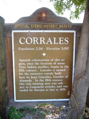
Corrales
Population 2,791 - Elevation 5,097
Spanish colonization of this region, once the location of many Tiwa Indian pueblos, began in the 17th century. Corrales is named for the extensive corrals built here by Juan González, founder of Alameda. In the 18th century this rich farming area was subject to Comanche attacks, and was raided by Navajos as late as 1851.
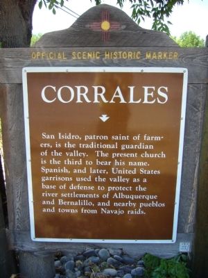
Reverse
San Isidro, patron saint of farmers, is the traditional guardian of the valley. The present church is the third to bear his name. Spanish, and later, United States garrisons used the valley as a base of defense to protect the river settlements of Albuquerque and Bernalillo, and nearby pueblos and towns from Navajo raids.
Erected by New Mexico Historic Preservation Division.
Topics and series. This historical marker is listed in these topic lists: Native Americans • Settlements & Settlers. In addition, it is included in the El Camino Real de Tierra Adentro series list. A significant historical year for this entry is 1851.
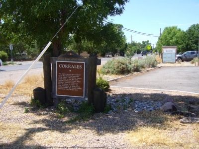
Location. 35° 13.201′ N, 106° 37.221′ W. Marker is in Corrales, New Mexico, in Sandoval County. Marker is at the intersection of Corrales Road (State Road 448) and Jones Road, on the right when traveling south on Corrales Road. Touch for map. Marker is at or near this postal address: 3949 Corrales Road, Corrales NM 87048, United States of America. Touch for directions.
Other nearby markers. At least 8 other markers are within 5 miles of this marker, measured as the crow flies. Iglesia de San Ysidro (approx. one mile away); Alameda (approx. one mile away); Tiguex Province (approx. 3.4 miles away); Dulcelina Salce Curtis (1904-1995) (approx. 3.6 miles away); Piedras Marcadas Canyon (approx. 4.3 miles away); Piedras Marcadas Trail (approx. 4½ miles away); a different marker also named Piedras Marcadas Trail (approx. 4½ miles away); a different marker also named Piedras Marcadas Trail (approx. 4.6 miles away).
Credits. This page was last revised on September 28, 2021. It was originally submitted on August 2, 2011, by Bill Kirchner of Tucson, Arizona. This page has been viewed 1,051 times since then and 39 times this year. Photos: 1, 2, 3. submitted on August 2, 2011, by Bill Kirchner of Tucson, Arizona. • Bernard Fisher was the editor who published this page.


