
Near Santa Fe in Santa Fe County, New Mexico — The American Mountains (Southwest)
Gold and Turquoise
Photographed by Bill Kirchner, July 22, 2011
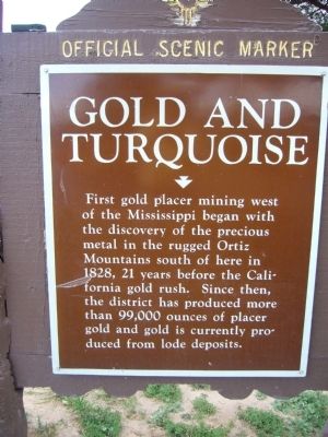
1. Gold and Turquoise Marker
First gold placer mining west of the Mississippi began with the discovery of the precious metal in the rugged Ortiz Mountains south of here in 1828, 21 years before the California gold rush. Since then, the district has produced more than 99,000 ounces of placer gold and gold is currently produced from lode deposits.
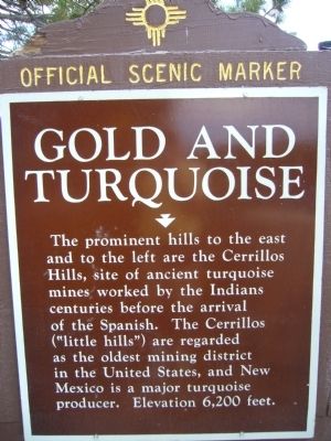
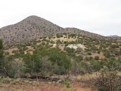
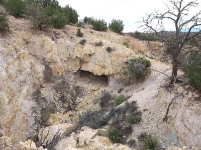
The prominent hills to the east and to the left are the Cerrillos Hills, site of ancient turquoise mines worked by the Indians centuries before the arrival of the Spanish. The Cerrillos (“little hills”) are regarded as the oldest mining district in the United States, and New Mexico is a major turquoise producer. Elevation 6,200 feet.
Erected by New Mexico Historic Preservation Division.
Topics. This historical marker is listed in these topic lists: Indigenous Peoples and Communities • Industry & Commerce. A significant historical year for this entry is 1828.
Location. 35° 31.639′ N, 106° 9.396′ W. Marker is near Santa Fe, New Mexico, in Santa Fe County. It can be reached from Interstate 25 at milepost 269, 1½ miles east of Waldo Canyon Road (County Road 57). The marker is located at the La Bajada
this page online

Regionally, this marker is in Northern New Mexico. It is also in the American Southwest, in the Mountain West, and on the Santa Fe Trail Corridor. Globally, it is in North America, the Rocky Mountains, the Western Hemisphere, the Western World, and the Anglosphere. Historically, it finds itself in what was once New Spain and also the Republic of Texas.
Other nearby markers. At least 8 other markers are within 3 miles of this marker, measured as the crow flies: Amelia Elizabeth White / Mary Cabot Wheelwright (a few steps from this marker); Bicentennial Celebration / La Bajada (a few steps from this marker); Laura Gilpin (1891-1979) (within shouting distance of this marker); Maria Gertrudis Barceló (within shouting distance of this marker); Three Wise Women (within shouting distance of this marker); Sisters of Charity (within shouting distance of this marker); Hispanic Women of Colonial New Mexico and Land Ownership (approx. 2.8 miles away); Hispanic Women of Colonial New Mexico and the Law / Doña Rosa Bustamante (1735-1814)
Photographed by Bill Kirchner, July 22, 2011
2. Gold and Turquoise Marker Reverse
Photographed by Bill Kirchner, July 22, 2011
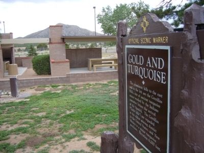
3. Gold and Turquoise Marker
The prominent hills to the east are the Cerrillos Hills.
December 15, 2023
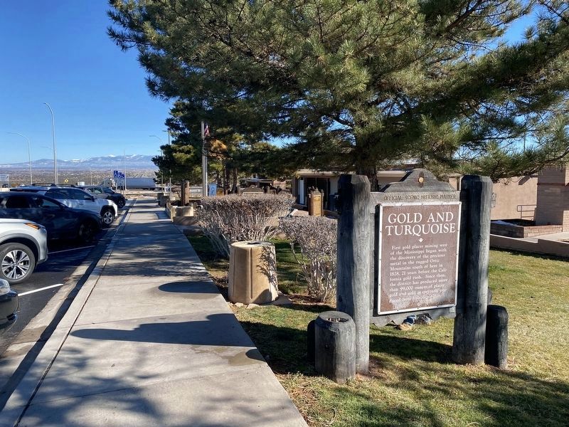
4. Gold and Turquoise Marker at the La Bajada Rest Area
Photographed by Richard Denney, October 16, 2013
5. Mount Chalchihuitl
Mount Chalchihuitl (peak in foreground) outside Cerrillos, New Mexico, site of ancient turquoise mines.
Photographed by Richard Denney, October 16, 2013
6. Turquoise Mine
One of several ancient turquoise mines atop Mount Chalchihuitl, outside Cerrillos, New Mexico.
Photographed by Richard Denney, October 16, 2013
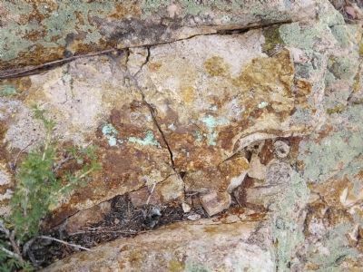
7. Streaks of Turquoise
Streaks of turquoise in rocks atop Mount Chalchihuitl
Credits. This page was last revised on December 25, 2023. It was originally submitted on August 3, 2011, by Bill Kirchner of Tucson, Arizona. This page has been viewed 1,181 times since then and 44 times this year. Photos: 1, 2, 3. submitted on August 3, 2011, by Bill Kirchner of Tucson, Arizona. 4. submitted on December 22, 2023. 5, 6, 7. submitted on March 12, 2015, by Richard Denney of Austin, Texas. • Bernard Fisher was the editor who published this page.
