Near Española in Rio Arriba County, New Mexico — The American Mountains (Southwest)
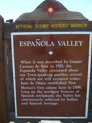
Española Valley
Erected by New Mexico Historic Preservation Division.
Topics and series. This historical marker is listed in these topic lists: Native Americans • Settlements & Settlers. In addition, it is included in the El Camino Real de Tierra Adentro series list. A significant historical year for this entry is 1591.
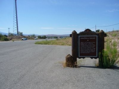
Location. 36° 0.92′ N, 106° 5.395′ W. Marker is near Española, New Mexico, in Rio Arriba County. Marker is on North Paseo De Onate (U.S. 84 at milepost 191), half a mile north of Fairview Drive, on the right when traveling south. Touch for map. Marker is in this post office area: Espanola NM 87532, United States of America. Touch for directions.
Other nearby markers. At least 8 other markers are within 4 miles of this marker, measured as the crow flies. Dominguez Escalante Trail (approx. 0.9 miles away); The Bond House (approx. 1.7 miles away); Chimayo Trading Post / Trujillo House (approx. 2 miles away); Shrine of Our Lady of Lourdes (approx. 2.9 miles away); Santa Cruz de la Cañada / Santa Cruz Plaza on the Camino Real (approx. 2.9 miles away); Esther Martinez - P’oe Tsáwäˀ (1912-2006) (approx. 2.9 miles away); San Gabriel (approx. 2.9 miles away); Pablita Velarde, Tse Tsan, Golden Dawn (approx. 3.1 miles away). Touch for a list and map of all markers in Española.
Credits. This page was last revised on April 26, 2020. It was originally submitted on August 5, 2011, by Bill Kirchner of Tucson, Arizona. This page has been viewed 983 times since then and 57 times this year. Photos: 1, 2, 3. submitted on August 5, 2011, by Bill Kirchner of Tucson, Arizona. • Bernard Fisher was the editor who published this page.


