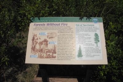
Forests Without Fire
The United States Forest Service performs “prescribed fires to clean up the forest floor and create habitat for wildlife. Small fires are like nature’s broom, sweeping up the buildup of dead plants on the forest floor and cleaning out the insects and disease. As the smoke clears grasses, shrubs and wildflowers are born in the ashes of the newly enriched soil attracting deer, elk and bighorn sheep. Aspen trees are the first trees to spring back after a fire providing homes for many birds and animals.
Tale of Two Forests:
Notice the difference between the types of trees on either side of the highway. Throughout Colorado, altitude, rain, snow and the amount of sunlight determine where each plant grows adapting to the conditions where they best survive.
Ponderosa Pine Forest:
Grow on sun-dried south-facing slopes.
Have adapted to surviving small, warm ground fires every 15 years.
Have thick bark to protect them from fire.
Vulnerable to attack by the mountain pine beetle.
Spruce-Fir Forest
Grow on cool,
Topics. This historical marker is listed in this topic list: Environment.
Location. 38° 54.034′ N, 104° 59.495′ W. Marker is near Colorado Springs, Colorado, in El Paso County. It is in Cascade. Marker is on Pike's Peak Toll Road. Marker is located at the Crowe Gulch turnout. Touch for map. Marker is in this post office area: Cascade CO 80809, United States of America. Touch for directions.
Other nearby markers. At least 8 other markers are within 3 miles of this marker, measured as the crow flies. Welcome to America’s Mountain (here, next to this marker); A New Home in the Hills (here, next to this marker); Ute Pass (approx. 0.7 miles away); Well-traveled Water (approx. 2.4 miles away); Test Your Bird I.Q. (approx. 2.4 miles away); The Making of America's Mountain (approx. 2.4 miles away); A Mountain of Many Names (approx. 2.4 miles away); Take a Closer Look...Foothills Life Zone (approx. 2.4 miles away). Touch for a list and map of all markers in Colorado Springs.
Credits. This page was last revised on February 7, 2023. It was originally submitted on August 10, 2011, by Charles T. Harrell of Woodford, Virginia. This page has been viewed 642 times since then and 11 times this year. Photo 1. submitted on August 10, 2011, by Charles T. Harrell of Woodford, Virginia. • Bill Pfingsten was the editor who published this page.
