Central in Denver in Denver County, Colorado — The American Mountains (Southwest)
Armenian Genocide
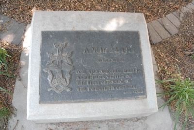
Photographed by Charles T. Harrell, July 2, 2011
1. Armenian Genocide Marker
Erected 1983.
Topics. This historical marker is listed in this topic list: Notable Events. A significant historical date for this entry is April 24, 1921.
Location. 39° 44.363′ N, 104° 59.056′ W. Marker is in Denver, Colorado, in Denver County. It is in Central. It can be reached from the intersection of E. 14th Ave. and Grant St.. Located near the east side of the Colorado State Capitol Building. Touch for map. Marker is in this post office area: Denver CO 80203, United States of America. Touch for directions.

Regionally, this marker is in the Front Range. It is also in the American Mountain West. Globally, it is in North America, the Rocky Mountains, the Western Hemisphere, the Western World, and the Anglosphere. Historically, it finds itself in what was once the Louisiana Purchase.
Other nearby markers. At least 8 other markers are within walking distance of this marker: Colorado State Capitol Time Capsule (within shouting distance of this marker); USS Colorado BB-45 (within shouting distance
this page online
Also see . . . Armenian Genocide - Armenian National Institute. (Submitted on August 18, 2011, by Bill Pfingsten of Bel Air, Maryland.)
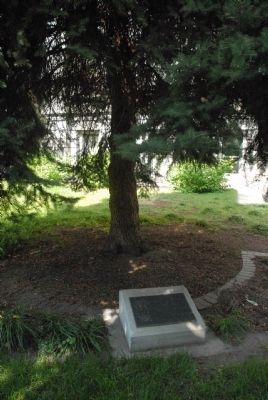
Photographed by Charles T. Harrell, July 2, 2011
2. Armenian Genocide Marker
Credits. This page was last revised on February 7, 2023. It was originally submitted on August 13, 2011, by Charles T. Harrell of Woodford, Virginia. This page has been viewed 1,359 times since then and 30 times this year. Photos: 1, 2. submitted on August 13, 2011, by Charles T. Harrell of Woodford, Virginia. • Bill Pfingsten was the editor who published this page.
