Lexington in Lafayette County, Missouri — The American Midwest (Upper Plains)
The Battle of Lexington
Sept. 18, 19 and 20, 1861
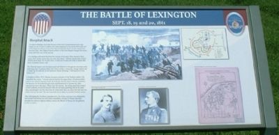
— Hospital Attack —
Col. Mulligan afterward described the action of his men, "they started at first, quick, then double quick, then on a run, then faster—still, the deadly drift of lead poured upon them, but on they went—a wild line of steel, and what is better than steel, irresistible human will.”
The Federals leaped onto the back porch and dashed in through the doorway as the defending State Guardsmen fled. One Union soldier, a musician, George Palmer, led a charge up the staircase in the Anderson House shouting, "1 will lead you if you will follow me!"
A Southern soldier, W. H. Mansur, became a prisoner of the Federal soldiers. He described the action, “I turned and ran back to the upper floor. A Federal soldier came at me with his bayonet fixed. He evidently did not want to kill me. I grabbed the bayonet, but he jerked the gun away and threatened to bayonet me, then marched me down the stairs. When near the bottom…the firing squad was ready, I turned suddenly, struck his bayonet with my left hand, grabbing him at the same time, and plunged over the dead into the lower hall, than ran down the hall into a side room on the east.” He was eventually led to safety by another Federal soldier.
After dislodging the Southern sharpshooters, the Union survivors were themselves surrounded and driven out with heavy causalities. George H. Palmer was later awarded the nation’s highest military award, the Medal of Honor, for his gallantry on this occasion.
Topics. This historical marker is listed in this topic list: War, US Civil. A significant historical date for this entry is September 18, 1849.
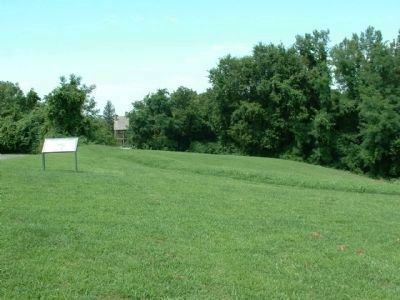
Location. 39° 11.459′ N, 93° 52.752′ W. Marker is in Lexington, Missouri, in Lafayette County. Marker can be reached from Wood Street, 0.1 miles east of 13th Street, on the left when traveling east. Marker is located on the north side of Wood Street near the entrance to the battlefield. Touch for map. Marker is in this post office area: Lexington MO 64067, United States of America. Touch for directions.
Other nearby markers. At least 8 other markers are within walking distance of this marker. A different marker also named The Battle of Lexington (about 300 feet away, measured in a direct line); a different marker also named The Battle of Lexington (about 300 feet away); a different marker also named The Battle of Lexington (about 400 feet away); a different marker also named The Battle of Lexington
(about 500 feet away); The Library Building (approx. 0.4 miles away); Mount Vernon Foundation Stones (approx. 0.4 miles away); Lafayette County Courthouse (approx. 0.4 miles away); Lexington (approx. 0.4 miles away). Touch for a list and map of all markers in Lexington.
Credits. This page was last revised on June 16, 2016. It was originally submitted on August 14, 2011, by Tony Meyers of Liberty, Missouri. This page has been viewed 662 times since then and 15 times this year. Photos: 1, 2. submitted on August 14, 2011, by Tony Meyers of Liberty, Missouri. • Craig Swain was the editor who published this page.

