Near McGregor in Clayton County, Iowa — The American Midwest (Upper Plains)
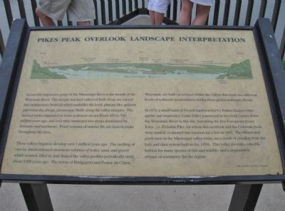
Pikes Peak Overlook Landscape Interpretation
Photographed by K. Linzmeier, June 18, 2011
1. Pikes Peak Overlook Landscape Interpretation Marker
These valleys began to develop over 1 million years ago. The melting of vast ice sheets released enormous volumes of water, sand, and gravel which scoured, filled in, and shaped the valley profiles periodically until about 9,500 years ago. The towns of Bridgeport and Prairie du Chein, Wisconsin, are built on terraces within the valleys that mark two different levels of sediment accumulation during these glacial meltwater floods.
In 1673, a small band of French explorers led by Father Jacques Marquette and mapmaker Louis Jolliet journeyed in two bark canoes down the Wisconsin River to this site, becoming the
this page online
Erected by Bruce and Susan Renaud.
Topics. This historical marker is listed in these topic lists: Exploration • Waterways & Vessels. A significant historical year for this entry is 1673.
Location. 42° 59.821′ N, 91° 9.8′ W. Marker is near McGregor, Iowa, in Clayton County. It is on Pikes Peak Road half a mile east of County Highway X56. Marker is at the overlook in Pikes Peak State Park. Touch for map. Marker is at or near this postal address: 32264 Pikes Peak Road, Mc Gregor IA 52157, United States of America. Touch for directions.

Regionally, this marker is in Northeast Iowa — the Driftless Area and in Eastern Iowa. It is also in the American Midwest, in the Corn Belt, in the Driftless
Photographed by K. Linzmeier, June 18, 2011
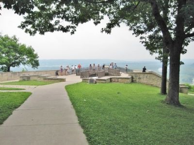
2. Pikes Peak Overlook and Marker
Other nearby markers. At least 8 other markers are within 4 miles of this marker, measured as the crow flies: Point of Discovery (a few steps from this marker); Passenger Pigeon Monument (approx. 1.8 miles away in Wisconsin); McGregor / Ringling Brothers (approx. 2 miles away); Camp Nelson Dewey (approx. 2.4 miles away in Wisconsin); Bat Caves (approx. 2½ miles away); Curtis Memorial Scientific Area (approx. 2.6 miles away in Wisconsin); Prairie du Chien Veterans Memorial (approx. 2.9 miles away in Wisconsin); Site of the Second Fort Crawford (approx. 3.3 miles away in Wisconsin). Touch for a list and map of all markers in McGregor.
Also see . . .
1. Iowa Department of Natural Resources. Pikes Peak State Park. (Submitted on August 15, 2011.)
2. Wisconsin River. Wikipedia entry. (Submitted on August 15, 2011.)
Photographed by K. Linzmeier, June 18, 2011
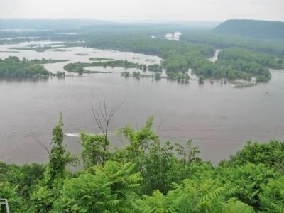
3. Confluence of the Wisconsin and Mississippi Rivers
The Wisconsin River is in the background, to the left of the bluffs that are at the right side of the photo.
Photographed by K. Linzmeier, June 18, 2011
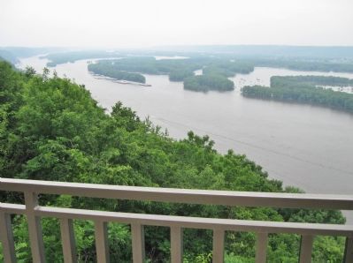
4. Mississippi River
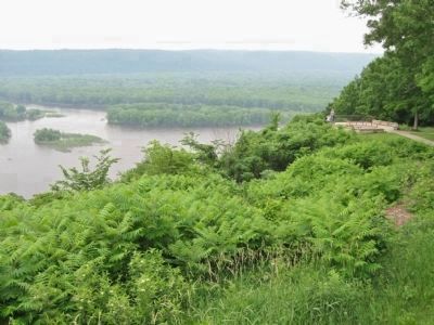
Photographed by K. Linzmeier, June 18, 2011
5. Mississippi River
Mouth of Wisconsin River
Credits. This page was last revised on June 16, 2016. It was originally submitted on August 15, 2011, by Keith L of Wisconsin Rapids, Wisconsin. This page has been viewed 1,176 times since then and 27 times this year. Photos: 1, 2, 3, 4, 5. submitted on August 15, 2011, by Keith L of Wisconsin Rapids, Wisconsin.
