Bloomsburg in Columbia County, Pennsylvania — The American Northeast (Mid-Atlantic)
Fort McClure
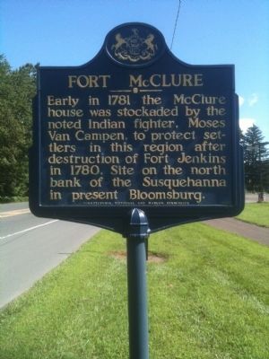
August 11, 2011
1. Fort McClure Marker
Erected by Pennsylvania Historical and Museum Commission.
Topics and series. This historical marker is listed in these topic lists: Forts and Castles • Indigenous Peoples and Communities. In addition, it is included in the Pennsylvania Historical and Museum Commission (PHMC) series list. A significant historical year for this entry is 1781.
Location. 40° 59.661′ N, 76° 28.392′ W. Marker is in Bloomsburg, Pennsylvania, in Columbia County. It is on West Main Street (U.S. 11) just south of Red Mill Road, on the left when traveling south. Touch for map. Marker is in this post office area: Bloomsburg PA 17815, United States of America. Touch for directions.

Regionally, this marker is in Anthracite Coal Region and in the Susquehanna Valley. It is also in the American Northeast, in the Mid-Atlantic, in Appalachia, and specifically in Northern Appalachia. Globally, it is in North
this page online
Other nearby markers. At least 8 other markers are within walking distance of this marker: Wyoming Path (a few steps from this marker); Welcome to Bloomsburg (approx. 0.2 miles away); Catawissa Friends Meeting (approx. 0.6 miles away); 261 West Main Street (approx. 0.8 miles away); 259 West Main Street (approx. 0.8 miles away); 246 West Main Street (approx. 0.8 miles away); Rupert (approx. 0.9 miles away); Rupert Covered Bridge (approx. 0.9 miles away). Touch for a list and map of all markers in Bloomsburg.
Also see . . . MarkerQuest - Fort McClure. (Submitted on November 3, 2022, by Laura Klotz of Northampton, Pennsylvania.)
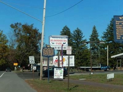
Photographed by Don Morfe, October 11, 2015
2. Fort McClure Marker-wide shot
Credits. This page was last revised on November 4, 2022. It was originally submitted on August 20, 2011. This page has been viewed 1,584 times since then and 107 times this year. Photos: 1. submitted on August 20, 2011. 2. submitted on October 22, 2015, by Don Morfe of Baltimore, Maryland. • Bill Pfingsten was the editor who published this page.
