Bonner - Loring near Bonner Springs in Wyandotte County, Kansas — The American Midwest (Upper Plains)
Kansas Indian Reservations
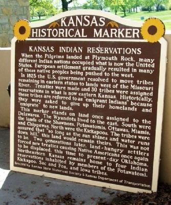
When the Pilgrims landed at Plymouth Rock, many different Indian nations occupied what is now the United States. European settlement gradually resulted in many of these native peoples being pushed to the west.
In 1825 the U.S. government resolved to move tribes remaining in eastern states to lands west of the Missouri River. Treaties were made and 30 tribes were assigned reservations in what is now eastern Kansas. Historically, these tribes are referred to as "emigrant Indians" because they were asked to give up their homelands and "emigrate" to new lands.
This marker stands on land once assigned to the Delawares. The Wyandots lived to the east. South were the lands of the Shawnees, Potawatomis, Ottawa, Miamis, and Chippewas. North were the Kickapoos. The tribes were assured that "so long as the sun shines and water runs down hill," this land would remain theirs. This was not to be. Two generations later, land-hungry settlers forced new treaties causing Native Americans once again to be displaced, this time to present-day Oklahoma. Northeastern Kansas remains home to four Indian reservations inhabited by members of the Potawatomi, Kickapoo, Sac and Fox, and Iowa tribes.
Erected by Kansas State Historical Society & Kansas Department of Transportation. (Marker Number 2.)
Topics and series. This historical marker is listed in these topic lists: Government & Politics • Native Americans • Settlements & Settlers. In addition, it is included in the Kansas Historical Society series list. A significant historical year for this entry is 1825.
Location. 39° 6.437′ N, 94° 52.084′ W. Marker is near Bonner Springs, Kansas, in Wyandotte County. It is in Bonner - Loring. Marker is at the Wyandotte County Museum, in Wyandotte County Park. Touch for map. Marker is at or near this postal address: 631 North 126th Street, Bonner Springs KS 66012, United States of America. Touch for directions.
Other nearby markers. At least 8 other markers are within 3 miles of this marker, measured as the crow flies. Kansas City, Kansas (here, next to this marker); The Ethnic Communities of Wyandotte County Sesquicentennial (a few steps from this marker); Bomber Builders (within shouting distance of this marker); The National Farmers Memorial (approx. 0.3 miles away); Julia Lee (approx. 2˝ miles away); The Golden Mean (approx. 2˝ miles away); Samuel Edward Ramey (approx. 2˝ miles away); "Jay" McShann (approx. 2˝ miles away). Touch for a list and map of all markers in Bonner Springs.
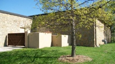
More about this marker. The marker has been moved from its original location and, as of April 2011, was in the outdoor storage area of the museum. Plans call for
the marker to be erected on the museum grounds.
Also see . . .
1. American Indian Tribes of Kansas. Native Languages of the Americas website entry (Submitted on August 21, 2011, by William Fischer, Jr. of Scranton, Pennsylvania.)
2. Indian History in Cutler's History of Kansas (1883). Kansas Collection Books website entry (Submitted on August 21, 2011, by William Fischer, Jr. of Scranton, Pennsylvania.)
3. History of Wyandotte County Kansas and its people. KSGenWeb website entry (Submitted on August 21, 2011, by William Fischer, Jr. of Scranton, Pennsylvania.)
Additional commentary.
1. Removed from State Inventory
As of January 2014, the Kansas Historical Markers page of the Kansas Historical Society website states, "The marker was removed from the state inventory."
— Submitted January 3, 2014, by Duane Hall of Abilene, Texas.
Credits. This page was last revised on February 10, 2023. It was originally submitted on August 21, 2011, by William Fischer, Jr. of Scranton, Pennsylvania. This page has been viewed 1,321 times since then and 61 times this year. Photos: 1, 2. submitted on August 21, 2011, by William Fischer, Jr. of Scranton, Pennsylvania.
Editor’s want-list for this marker. Photo and coordinates of marker once it has been erected on park grounds. • Can you help?

