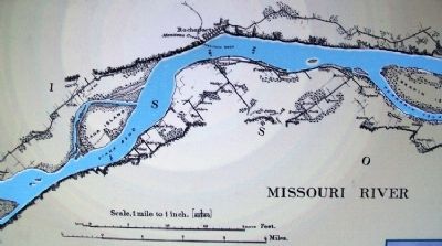
Rocheport in Boone County, Missouri — The American Midwest (Upper Plains)
Steamboating on the Missouri
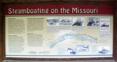
First Steamboats
Early steamboat trips on the Missouri River tested boats, crews and passengers. Between 1820 and 1900, several hundred steamboats on the Missouri were destroyed by fire or boiler explosions, crushed by ice, or sunk by snags. The first steamboat to navigate a significant distance on this untamed river was the Independence. In May 1819, the Independence set out from St. Louis loaded with flour, whiskey, iron, sugar and passengers. After 13 days and 150 miles, the boat reached Franklin, Mo., and was greeted by a huge celebration. The Independence continued to Chariton before returning to St. Louis.
An Army Expedition
The success of the Independence fueled enthusiasm to travel the Missouri River by steamboat. In June 1819, an army expedition of four steamboats and nine keelboats headed to the Yellowstone River in present-day Montana. Maj. Stephen Long led the scientific part of the expedition in the Western Engineer, and stopped at Franklin for a week-long celebration. But one by one, the remaining boats fell far behind. In a year's time, the expedition progressed only 860 miles, and the boats were deemed unfit to continue. Congress cancelled further funding of the expedition. It would be 13 years before another steamboat, the Yellowstone, completed the journey.
Steamboats Draw Rocheport Residents
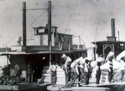
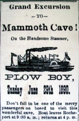
As steamboats became more reliable, boats carried people and goods up and down the river. For Rocheport residents, moonlight excursions on steam ferries were a favorite recreation. In 1836, the sidewheeler Diana sank on a snag at today's Diana Bend, about 2 1/2 miles above Rocheport. The Little Dick steam ferry took pasengers in 1880 and 1881, then sank. In 1890, the Plow Boy advertised a grand excursion to Mammoth (now Rocheport) Cave, three miles below Rocheport.
End of an Era
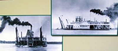
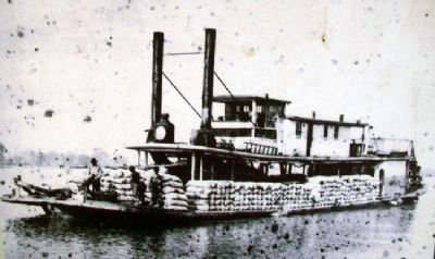
Steamboating on the Missouri lasted from 1819 through the 1920s. Railroads gradually took away passengers and long-haul freight from boats. By 1910, a few family-owned companies operated small freight boats, mostly along the Gasconade and Osage rivers where railways were fewer. These companies also carried passengers on day trips. Steamboat trade helped build Missouri's river towns. In fact, Rocheport was a major shipping port for tobacco and hemp before the Civil War.
Erected by Missouri Department of Natural Resources.
Topics. This historical marker is listed in these topic lists: Exploration • Industry & Commerce • Settlements & Settlers • Waterways & Vessels. A significant historical month for this entry is May 1819.
Location.
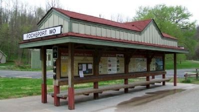
38° 58.65′ N, 92° 33.651′ W. Marker is in Rocheport, Missouri, in Boone County. Marker kiosk is adjacent to the former railroad passenger depot, along the Katy Trail State Park, and about 300 feet ESE of the intersection of Pike and 1st Streets. Touch for map. Marker is in this post office area: Rocheport MO 65279, United States of America. Touch for directions.
Other nearby markers. At least 8 other markers are within 10 miles of this marker, measured as the crow flies. Edward D. "Ted" and Pat Jones (here, next to this marker); Katy Trail State Park 20th Anniversary (here, next to this marker); History of Rocheport (here, next to this marker); Boonville (approx. 8.6 miles away); Hannah Cole's Fort (approx. 9.2 miles away); The Battle of Boonville (approx. 9.3 miles away); a different marker also named Battle of Boonville (approx. 9.3 miles away); Santa Fe Trail (approx. 9.7 miles away). Touch for a list and map of all markers in Rocheport.
Also see . . .
1. A Brief History of Steamboating on the Missouri River wth Emphasis on the Boonslick Region. Missouri GenWeb website entry (Submitted on August 21, 2011, by William Fischer, Jr. of Scranton, Pennsylvania.)
2. The Early History of Steamboats on the Missouri River. Big Muddy Speaker Series website entry (Submitted on April 22, 2022, by Larry Gertner of New York, New York.)
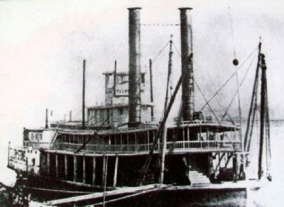
Photographed By Unknown, undated
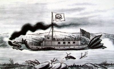
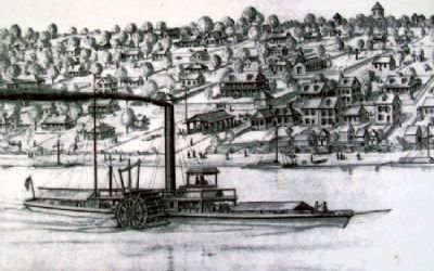
4. Zeb Pike Drawing on Steamboating Marker
[Caption reads] In 1817, the Zebulon M. Pike was the first steamboat to St. Louis. The Missouri River was considered too dangerous to attempt. Reprinted with permission of the St. Louis Post-Dispatch, copyright 1968. Courtesy of State Historical Society of Missouri.
Credits. This page was last revised on June 13, 2022. It was originally submitted on August 21, 2011, by William Fischer, Jr. of Scranton, Pennsylvania. This page has been viewed 1,696 times since then and 73 times this year. Photos: 1, 2, 3, 4, 5, 6, 7, 8, 9, 10, 11. submitted on August 22, 2011, by William Fischer, Jr. of Scranton, Pennsylvania.
