Near Daviston in Tallapoosa County, Alabama — The American South (East South Central)
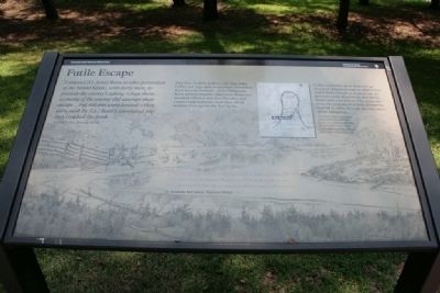
Futile Escape
Horseshoe Bend National Military Park
— National Park Service, U.S. Department of the Interior —
I ordered [Lt. Jesse] Bean to take possession of the Island below, with forty men, to prevent the enemy's taking refuge there...as many of the enemy did attempt their escape...but not one were landed-they were sunk by [Lt.] Beans command ere they reached the bank.
Gen. John Coffee, Tennessee Militia
Maj. Gen. Andrew Jackson sent Gen. John Coffee and 1,300 men to surround Horseshoe Bend here on the banks of the Tallapoosa River. Jackson hoped Coffee's 700 Tennessee mounted riflemen and 600 Cherokee and Lower Creek warriors could close off all avenues of escape for the Red Sticks.
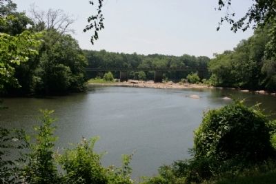
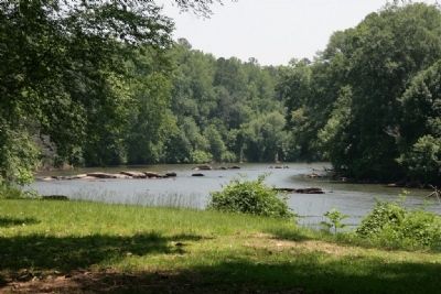
Coffee ordered Lt. Jesse Bean and 40 mounted riflemen to wait on what is now called Bean's Island, in front of you. As Jackson's army attacked the Red Sticks, Bean's men aimed their rifles across the river, shooting any Red Stick attempting to swim to safety through the cold waters of the Tallapoosa.
[The] Tallapoosa might truly be called a River of blood for the water was so stained that at 10 O'clock at night it was very perceptibly bloody so much that it could not be used.
Lt. Alexander McCulloch, Tennessee Militia
Erected by National Park Service, U.S. Department of the Interior.
Topics and series. This historical marker is listed in these topic lists: Native Americans • War of 1812. In addition, it is included in the Former U.S. Presidents: #07 Andrew Jackson series list.
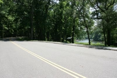
Location. 32° 58.62′ N, 85° 44.263′ W. Marker is near Daviston, Alabama, in Tallapoosa County. Marker is on Battlefield Park Tour Road, on the right when traveling south. Touch for map. Marker is at or near this postal address: 11288 Horseshoe Bend Road, Daviston AL 36256, United States of America. Touch for directions.
Other nearby markers. At least 8 other markers are within walking distance of this marker. Horseshoe Bend Battleground Monument (about 700 feet away, measured in a direct line); Gun Hill (about 700 feet away); Major Lemuel P. Montgomery (approx. 0.2 miles away); Jackson Trace (approx. 0.2 miles away); While the Long Roll Was Beating (approx. 0.2 miles away); Charge! (approx. 0.2 miles away); Designed for Defense (approx. 0.2 miles away); Who Were the Creek? (approx. 0.2 miles away). Touch for a list and map of all markers in Daviston.
Also see . . .
1. Horseshoe Bend National Military Park. (Submitted on August 22, 2011, by Timothy Carr of Birmingham, Alabama.)
2. Battle of Horseshoe Bend. Encyclopedia of Alabama entry. (Submitted on August 22, 2011, by Timothy Carr of Birmingham, Alabama.)
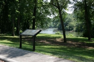
Photographed By TRCP Alliance, June 16, 2011
3. Horseshoe Bend National Military Park Marker Tour Stop #1 The Island
The Island
On March 27, Coffee ordered 40 men of Lt. Jesse Bean’s Tennessee Militia company to occupy this 15-acre island. Their mission was to prevent Red Stick warriors seeking refuge there. Many Creeks did attempt to escape to the island but were “sunk by Lt. Bean’s command ere they reached the bank.”
From Horseshoe Bend National Military Park Map and Guide Brochure
Credits. This page was last revised on September 4, 2020. It was originally submitted on August 22, 2011, by Timothy Carr of Birmingham, Alabama. This page has been viewed 1,190 times since then and 32 times this year. Photos: 1, 2, 3, 4, 5, 6. submitted on August 22, 2011, by Timothy Carr of Birmingham, Alabama. • Craig Swain was the editor who published this page.
