Perryville in Boyle County, Kentucky — The American South (East South Central)
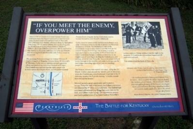
“If You Meet the Enemy, Overpower Him”
Perryville • The Battle For Kentucky
— October 8, 1862 —
The pursuing Federals belonged to Colonel William P. Carlin’s brigade of Brigadier General Robert B. Mitchell’s 9th Division. Carlin was an experienced and aggressive officer, and pushed his command forward with vigor. The Confederates realized that the safest course was to retire across the Chaplin River and Brigadier General Preston Smith’s brigade, the last Confederate reserve, hurried forward to cover Powell’s withdrawal.
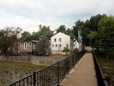
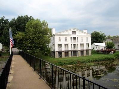
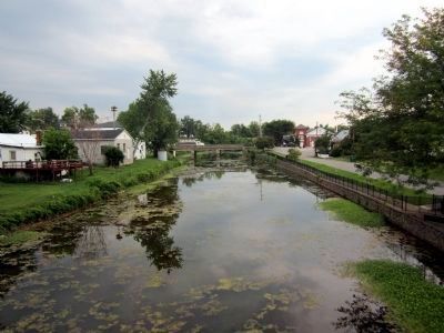
Carlin placed 4 cannon of the 2nd Minnesota Battery on a ridge overlooking town (at the site of present-day Perryville Elementary School). The Federal guns shelled the Confederate troops as they tried to cross the river via the covered Second Street Bridge (site of today’s modern highway bridge) or the causeway at Third Street (site of today’s pedestrian bridge). Confederate batteries on the heights east of town began shelling the Federal guns, and artillery rained all over Perryville. Several structures suffered severe damage in the crossfire, and some buildings near the two bridges (including right where you are standing) caught fire.
The Federal infantry then moved into town, led by the 21st Illinois. Carlin’s men secured the western part of Perryville, while the Confederates retired eastward. A private in the 1st Arkansas recalled the Federals making “a terrible assault from behind the houses.”
Mitchell sensed a great opportunity and wanted to occupy Perryville with more troops, but Gilbert intervened and directed the 9th Division to hold back. The Federal high command still believed that Bragg had more men on the field, and Gilbert feared a trap. The opportunity passed, and Carlin pulled most of his forces back to Perryville’s western outskirts. Firing continued into the night; in the darkness, 15 Confederate ammunition wagons and 68 men were captured.
This action ended the Battle of Perryville.
“Advance and if you meet the enemy, overpower him.”
Colonel William P. Carlin to Colonel Hans C. Heg, 15th Wisconsin Infantry
“The Yankees planted a battery and turned it on the town…when we got to the street [Second Street] the Yankees got our range…the shells came thick and went through many of the houses. We stayed there a few minutes, then they called us to order. We went in double quick time down the street. We got out of town.”
Private Richard Wharton, 154th Veteran Tennessee Infantry
Erected by The Perryville Enhancement Project and the Louisville Civil War Roundtable.
Topics. This historical marker is listed in this topic list: War, US Civil. A significant historical month for this entry is October 1817.
Location. 37° 38.949′ N, 84° 57.099′ W. Marker is in Perryville, Kentucky, in Boyle County. Marker is at the intersection of South Buell Street (U.S. 68) and West Third Street, on the left when traveling south on South Buell Street. Touch for map. Marker is in this post office area: Perryville KY 40468, United States of America. Touch for directions.
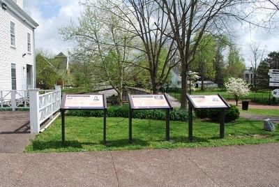
Other nearby markers. At least 8 other markers are within walking distance of this marker. The City of Perryville (here, next to this marker); Perryville in the Crucible of War (here, next to this marker); Bragg's Invasion of Kentucky (a few steps from this marker); The Battle of Perryville (within shouting distance of this marker); Merchants' Row / Street Fighting (about 300 feet away, measured in a direct line); Karrick-Parks House / Harberson's Station (about 400 feet away); First Settlement of Perryville (about 400 feet away); a different marker also named Battle of Perryville (about 500 feet away). Touch for a list and map of all markers in Perryville.
More about this marker. On the lower right is a “You are here” map.
On the upper right is a photograph of “William P. Carlin (second from left) and staff, shown later in the war”.
Credits. This page was last revised on April 29, 2021. It was originally submitted on August 23, 2011, by Bernard Fisher of Richmond, Virginia. This page has been viewed 1,425 times since then and 40 times this year. It was the Marker of the Week October 7, 2012. Photos: 1. submitted on August 23, 2011, by Bernard Fisher of Richmond, Virginia. 2. submitted on September 15, 2015, by Brandon Fletcher of Chattanooga, Tennessee. 3, 4, 5, 6. submitted on August 23, 2011, by Bernard Fisher of Richmond, Virginia.
